Sunday, March 25, 2012

A Rendezvous With the Manatees

A few weeks ago we had the opportunity to do some paddling in Florida while visiting relatives.  This blog entry is a photo album of our adventures kayaking in and around the west-central portion of the sunshine state.

Our first trip required an early start.  Our intent was to "swim with the manatees".  In cooler months, these friendly, warm-blooded aquatic creatures prefer to sleep in or near the springs which flow year-round at 72 degrees, so they congregate at certain locations each night.  This behavior affords people the chance to interact with them.  There are many local businesses that will shuttle folks to the springs and lend them a wetsuit and snorkeling equipment for a fee, but my wife and I generally shun the touristy-type package deals and opt instead for planning our own adventure.

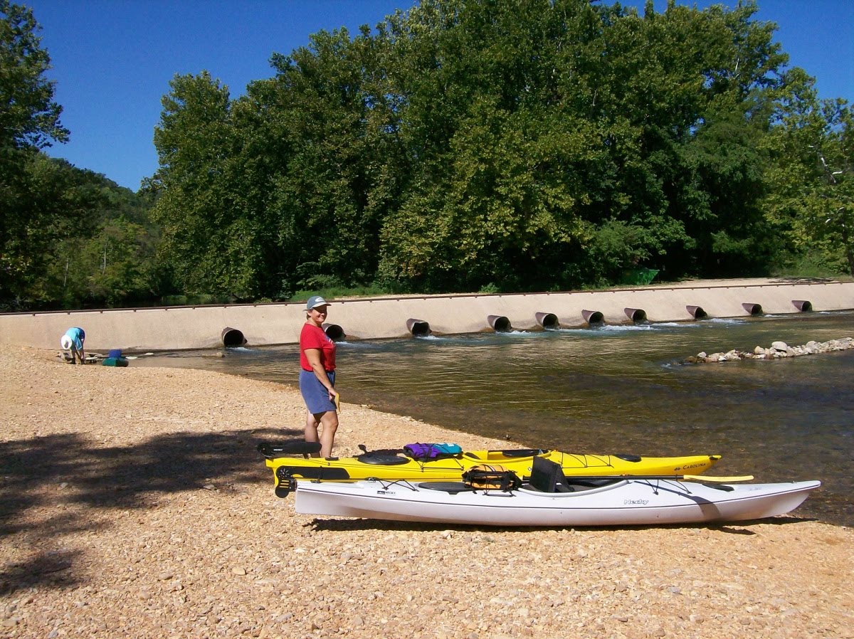
So we woke at 4:30am, had some breakfast, slipped into our neoprene, and headed for the small town of Crystal River which is about 20 miles southwest of where we were staying.  We arrived there, unloaded the kayaks, and launched from a free boat ramp on SW 3rd Avenue at around sunrise.  Don't forget to click the images to enlarge them.


launching at dawn into the calm waters of King's Bay


We made our way over to "Three Sisters Spring" which was about a half-mile from our put-in.  Once there we were greeted by signs informing us that tying boats up to vegetation was prohibited, but we came prepared with various lengths of rope and carabiners so we simply tied on to an underwater rock.

Since neither my wife or I are surfers, this was our first time using a wetsuit.  We were amazed how well they functioned.  I hate cold water (which I define as anything less than 88 degrees) and I stayed warm as toast the whole time we were swimming.

It wasn't long before we made our first contact with one of the sea cows.  We swam upstream into the spring and came upon this little guy...


I say "little" although he (or she) was still enormous.  It was about six feet long, but they can grow to be more than twice that length and some of the ones we saw later were indeed at least ten feet long with a girth to match.  Unfortunately, as more and more people arrived on the pontoon boats, the water got stirred up with debris which affected the clarity of the pictures we took with our cheapo Kodak underwater camera.  You can find much better photos of manatees on the internet so I have only posted a few of the ones we took that day.


So, we got to see the huge beasts up close and personal.  Quite an experience I must say, and certainly worth the $50 fee if your only alternative is to pay for the privilege.  We spent about an hour and a half in the water with them and another 30 minutes or so paddling the springs where only hand-powered craft and swimmers are allowed.


looks inviting, don't it?


We followed a different lagoon route back to the bay in order to check out some of the homes that line the waterfront.  Back in the bigger water, it only took a few minutes to find a secluded beach where we could surreptitiously change out of our wetsuits.


We then proceeded to follow the Crystal River out towards the Gulf of Mexico. After paddling for a couple of hours, we stopped for an early lunch at "Fort Island Trail Park".  There are restrooms, a pavilion with picnic tables overlooking the river, barbeque grills, a fishing pier, and a boat ramp at this location.  A perfect spot to take a break.


Here's my trusty steed moored to a floating dock.  The other yak is on the opposite side but you can't see it in the picture.  Behind them is a footbridge that leads to the picnic area.


A few more miles of paddling and we came to the mouth of the river.  Our yaks proved themselves seaworthy in the open water of the Gulf.


We paddled out to an uninhabited spot called Shell Island to have a look around.  This visitor gave the place a thumbs up.


 Our final destination for the day was Fort Island Beach.  The 80 degree sunny afternoon was apparently a good enough excuse to skip work and relax with the family at this free park which was packed with visitors.  It just so happened that as we were pulling our boats out of the water, another solo kayaker/fisherman was throwing his boat in the back of his truck and I was able to bum a ride with him back to town to retrieve our vehicle.  Less than an hour later we had our yaks back on the roof racks and all our gear stowed.  A little catnap on the beach, a quick rinse off in the outside shower, a change of clothes, and we were ready to cap off our day with dinner at The Plantation Inn.


We enjoyed a sumptuous meal, served by a professional and attentive staff.  Best of all the bill was only $23 plus tip since we had a coupon from restaurant.com.  A perfect ending to a perfect day!


Click THIS link for a short video of the manatees.  Sorry it's so shaky at the end... when I figure out how to trim off the last 20 seconds I will replace it.


Saturday, August 28, 2010

Squiggly Blue Lines

Has it really been over two years since I last posted to this blog? I'm surprised Google hasn't deleted it for lack of use! My excuse is it's been a busy time with lots of major changes. In 2009 my wife and I stopped complaining about the noise, pollution, congestion, traffic, high taxes, and general lack of personal liberty in NJ and acted on our desire to spend the remainder of our days living out in the country. So we sold the big house and moved west. About 1100 miles west. We now live in a modest home on a few acres in the middle of the Missouri Ozarks. We raise chickens, eat food that we grow in our garden, and see the Milky Way every cloudless night. The nearest town (population 555) is eleven miles away, which gives a clue how rural we're talking about here. Property taxes are about a tenth of what we used to pay in NJ, and the cost of nearly everything is significantly less. So far, it seems we made a good choice on where to move. But the purpose of this journal is to chronicle our recreational pursuits, so let's move on.

The dog days of August are perfect for escaping daily routines and making time for some R&R. Head to the beach, do some fishing, recline in the shade with a good book... there are countless ways to slow down the pace of life and enjoy the outdoors before another summer fades into fall. After several consecutive weeks of unrelenting extreme heat and humidity, the return to normal temperatures was a welcome relief. A cool front came through a few days ago and brought with it some delightful weather. That's all the prodding my wife and I needed to dust off the kayaks and plan a float trip down one of our local rivers.

South-central Missouri is somewhat of a paddling mecca. Folks come from far and wide to patronize the dozens of rental / livery services that get you equipped and on the water for a fee. As you might expect, there is very good reason for this popularity. The area has some of the most incredible scenery to be had anywhere in the country. Indeed, the US National Park Service oversees sections of both the Current and Jack's Fork Rivers as a means to protect the natural beauty found along their banks. You can click on the photo below for a larger view or go HERE for a downloadable hi-res pdf map of the area.


With 150 or so navigable miles of river to choose from
within a 30-minute drive, the next question becomes which section(s) to do first. Alley Spring is one of the prettiest and most interesting places we have seen since moving here a little over a year ago. In addition to the spring itself which has an average daily flow of 81 MILLION gallons per day, one will find a 100+ year-old mill, hiking trails, a picnic area, and a campground. Our familiarity with Alley made it a natural choice so we paddled the section from there to the town of Eminence. Why had we waited so many months before making time to paddle? The scenery was simply awesome. Unfortunately we had no camera along on that trip, but those few hours on the water is all it took to rekindle the paddling bug. We promised ourselves we would do it again very soon.

Providentially, we recently met a local couple who are also avid kayakers. They have extensive experience with these local streams and graciously offered to "show us around". Al and Pam are great folks from New Orleans who chose to retire in Missouri primarily because of their fondness for the local waterways... our kinda people! It didn't take long before a plan was hatched and we were sharing adventures together. The pictures that follow are from the second and third trips we did with them. Don't forget that you can click on any of the pictures for a full-sized image.


ready, set, ....go!


The stretch of the Current River described herein begins at the Cedar Grove put-in near the tiny town of Jadwin. Dent County road ZZ ends right at the river. Yes, that's double Z as in zebra. They use letters instead of numbers to label some of the roads here in Missouri. :)   Our takeout point the first day was at Welch Landing which is a short distance off County Road K near Aker's Ferry.  Our put-in the second day was at Akers and our takeout was at the Pulltite rec area located at the end of County Road EE.


just another bluff


Portions of this river route are very canyon-esque. Vertical rock walls rising straight out of the riverbed are common on the Current and Jack's Fork. There are also more than 6000 caves in Missouri with a high concentration of them in this particular area due to the karst topography of the region. Some of these are accessible directly from the river.


vanilla, cherry, lemon, or lime?


These yakkers are a colorful bunch, aren't they? Polyethylene is a wonderful thing! I thank God for making all those Tyrannosaurus Rexes every time I slip into my sleek, waterproof, incredibly durable kayak. :)


our tourguides


Speaking of Divine Providence, our newfound friends Al and Pam are graciously showing us the best places to go and the many hidden treasures along the way that we would otherwise paddle right past. We thoroughly enjoy their company and look forward to many more float trips together.


"RIVER RIGHT !!"


Case in point, here they are leading us through one set of particularly treacherous rapids. Just kidding... I don't think there is even a single "class 2" rapid to be found on these rivers except perhaps in early spring or immediately after a heavy rain. The turbulence in the photo above is being generated by Welch Spring which adds an average of 105 million gallons of water per day to the Current River's flow. We all took turns "surfing" the twelve-inch waves.


a pleasant surprise


We unexpectedly got an up close and personal view of an American Bald Eagle on this trip. He/She remained still for the camera as we glided quietly 20 feet below his/her perch. I've watched the live nest-cam feeds that are available on the web, but this is the closest I've ever been to one in real life. Pretty awesome!


a pretty sight


Horseback riding is another way to enjoy the beauty of the Ozarks.  People come from all over tarnation to participate in organized trail rides and pack trips up to a week long.  The folks in the picture were locals just out for a Sunday jaunt close to home.  There are also two herds of wild horses that wander free in the area.  We hope to encounter them along the river someday.


young buck with no fear


I was sure this whitetail would bolt as we approached but he seemed as interested in us as we were in him.  We glided past only thirty feet from this handsome fella.


Caves are cool !  Caves that you can paddle right into are even cooler!  This one was simply amazing.  Once beyond the mouth it opens into a large cavern.  As you can see in these pictures there was plenty of room inside for all four of our boats.


there's no place he'd rather be


So that's it for this installment. Hopefully I'll be able to add more interesting stories and pictures in the coming weeks and months. Stay tuned!

Monday, May 12, 2008

Section Hiking in Rocksylvania


Ahhhh, spring. Winter's grip on NJ is finally broken. Break out the t-shirts and shorts. Watch as the landscape gets a bit greener each day. Plan the next outdoor adventure.

Living so close to the famed Appalachian Trail, it inevitably acts like a magnet for those of us who are familiar with its pleasures. As soon as the mercury begins topping 60 degrees on a regular basis, we can feel it beckoning us to return and tread its well-worn path. Of course this year is no different than any other in that regard, so when the son of family friends informed me that he was going to be spending several days on the trail with some of his college buddies and invited me to come along, I jumped at the opportunity.

When "the plan" was revealed to me just prior to the trip's start, my first reaction was that 16-18 miles per day sounded like a bit much. I knew from previous experience that this particular stretch was no stroll in the park. The AT in Pennsylvania is well known among hikers as an extremely rocky portion of the 2175 mile trail. There are some sections where it seems you go for miles without your feet touching one square inch of soil. When you DO come to the occasional patch of "normal" trail, your battered soles breathe a sigh of relief, but these segments are teasingly short-lived. On the other hand, the added stress placed on one's lower body by this part of the trail is just another challenge to be overcome by those who are not easily discouraged.

imagine mile after mile of this

Still, 18 mile days are always l-o-n-g days of walking with precious little time for an afternoon nap or other diversion. Could this 54 year-old guy still do that kind of mileage? And not knowing how experienced the others were, I even had my doubts whether everyone in this group would be able to handle that much distance per day. So, feeling obligated to at least note my opinion, I sent my concerns via email to Bill, the only one in the group who I knew personally. I was fully expecting to be ignored by the invincible young bucks, which is pretty much what happened. Don't get me wrong... I didn't mind at all, and I would have done the same in their position. This was THEIR trip, not mine. I was just the old guy who would be tagging along and probably slowing everybody down. Although I am often the one cast in the role of trip planner, that responsibility was being shouldered by someone else this time and I was actually grateful that I did not have to partake in the decision making process. I suppose that was part of the appeal for me... I didn't have to do anything but grab my pack and show up. If I couldn't handle it, then I'd simply hike at whatever pace I felt comfortable. I am no stranger to solo treks, and my pack always includes everything I need to be fully self-sufficient for the duration of any adventure. I was fully aware of and prepared for the possibility that I wouldn't see them the entire four days. Also, on some masochistic level I guess I looked forward to finding out how much punishment the old bod could still take.
The others began their hike on a Sunday afternoon in Wind Gap, which coincides with the beginning of section 2 of the trail according to the official Appalachian Trail Guide. They hiked about 4 miles in to the Leroy Smith shelter and spent the night there. The next day they walked their first full day, doing a grueling 17+ miles and ending up at the Outerbridge shelter. This is where I caught up with them. My wife dropped me off Monday evening at the junction of the trail and route 873 in Lehigh Gap and I hiked the 7/10ths of a mile up to the lean-to they had claimed for the night. I met the other two members of this expedition for the first time, Tyler and Patrick, both likable fellows.


signage
After the introductions and some small talk, I continued to follow the white blazes in the diminishing light and then swung onto the North Trail, a blue-blazed path that parallels the main route but is far more scenic. I made my way up to the ridge and emerged out onto a bald overlooking the Lehigh River Valley. The sun had just set so I pulled the camera out to record the moment. Don't forget to click on the pictures to enlarge them!
view from the top

I wandered around for the next twenty minutes or so enjoying the vista and looking for a place to set up camp. There were only a few scraggly trees that had managed to take root out on this exposed summit, so finding two appropriately sized and spaced trunks proved difficult. I could have easily found something suitable at the edge of the bald but preferred, if possible, to set up where I could enjoy the incredible 270-degree view from my hammock. Eventually I located what I wanted and strung up my perch for the night. After hanging my food nearby and changing out of my shorts, I stretched out on one of the bigger rocks that was still warm from soaking up the sun's rays all day. By this time it was completely dark and the lights of civilization were twinkling in the distance. I love campsites like this, they're always the highlight of any trip for me... very conducive to introspection and prayer. I sat quietly for nearly two hours gazing out over the surrounding landscape while enjoying my bedtime snack.

stealthin' it

As soon as the sun broke above the top of the blue ridge the next morning, I was up and about. I made my usual oatmeal breakfast, packed up, and prepared to move on. First, though, I made a little side trip down to "Devil's Pulpit" to see if the view from there was any better. It wasn't, but it made for a nice half-mile (round-trip) leg-stretch. I grabbed my pack and headed southwest, leaving my campsite at precisely 8:45am.

tuesday morning

the magical levitating food bags

pioneer spirit?


i'm sure there's a story about this place

The North Trail stays out on the exposed ridge for the next couple of miles, so there were many good views. I saw a wild turkey scurry into the brush when I startled it. Bill, who followed this same route a couple of hours later, actually got to see a bear feeding along this section. Somewhere around the 2.5 mile mark, this blue-blazed trail turns back into the woods and rejoins the AT. Around noon I came to Bake Oven Knob shelter, a smallish, older lean-to with water nearby. I tanked up, left a note for the others, and headed on.

just passin' thru

The actual summit of Bake Oven Knob was a mile or so farther and offered a decent view. I stopped for a snack a short time after that along a power cut, then plodded on for another four miles and had a hot lunch up on Baer Rocks, another overlook. Next it was down to the Rt. 309 road crossing which marks the end of section three, then up the other side. Another four miles of fairly level walking brought me finally to the Allentown shelter, the group's pre-determined destination for this day. It was exactly 6pm when I arrived at the empty hut and I wondered how long it would be before the boys would show up. It had been an 18 mile day, plus or minus a few tenths, and I was exhausted. But I had done it! I recalled how a decade ago my wife and I had done 15 of those miles over the course of TWO days, and I had just accomplished 20% more distance in only ONE day. Yeee-haaaa!

now THAT'S a nice shelter!

My reveling was brief... Tyler and Bill showed up a mere ten minutes after me. Then I found out they had started more than two hours later than I did that morning! Pffffffffffft. Back to reality. But... but... they're at their physical prime. Plus I took a full hour for lunch while they took barely twenty minutes by their accounting. Anyway, we were all glad that we were done for the day. Patrick rolled in about an hour later, we ate dinner, then sat around comparing notes as the last light faded.

this is what "five bars" looks like


Speaking of notes, one point I thoroughly enjoyed making repeatedly on this trip concerns footwear. You see, after I cut some ten pounds from from my total pack weight last year, I discovered that I can now wear regular old sneakers on the trail instead of boots. I tried this for the first time last fall on a similar hike and knew from that experience that I could safely leave my vibram soles at home and travel in my comfortable everyday sneaks, plus I didn't need to bring a second pair of "around camp shoes", which further decreased my pack weight. Predictably, however, my bright white $12 K-Mart specials sometimes drew snickers from other hikers. In a setting where gear comparisons and pride in one's equipment runs higher than average, I'm sure many false assumptions were made regarding my level of backcountry knowledge and expertise as a result of this choice. But hopefully a few pre-conceived notions (likely derived from manufacturers' "need-generating" glossy ad pages) have been called into question by cold, hard, real-life observations. The interesting thing (for me) on this particular trip was that, of the four of us, I was the only one who never got even one blister. Indeed, I had the last laugh watching the others perform their nightly foot care routine.

go ahead, laugh it up suckers! :-)

The next morning I slept later than usual and barely got out of camp before the sleepyheads. Patrick hit the trail first and I left a few minutes behind him.
some of us claimed to "need" more sleep than others


at least one of 'em knows when to GET UP!

It was gonna be another big-mileage day, so I kept a brisk pace and took few breaks. As a matter of fact, I didn't rest at all until I got to Dan's Pulpit around noon.
Patrick showed up about 10 minutes later. He had taken a short side trail up to Tri-County Corner and we figured that must be where I unknowingly passed him. After a 15-minute break here, he, then I, resumed our trek. I caught up with him a while later at a bridge over a good-sized stream. It was here that I learned of Eckville shelter which was not mentioned in my circa 1980 guidebook, but WAS in his. It seemed like a good lunch destination and it was only a half mile ahead, so I left him soaking his feet in the cool water and took the lead once again.
panther creek, "always flowing"

Patrick's guidebook indicated that the Eckville shelter was one of those that had a "caretaker", and even more of interest to a dirty, sweaty hiker, a SHOWER. I wasn't there but two minutes and I had my towel, washcloth, and soap out of my pack and was headed for the little outbuilding. Man, did that cold water feel good! As I sat at the breezy picnic table eating my peanut-buttered bagels, the others strolled up. Evidently, the prospect of a refreshing shower wasn't as appealing to the rest of the gang. They just snacked and rested a bit before we all resumed our journey back up to the ridge.

one of the few AT shelters with flush toilets and showers


The caretaker had assured us that it was an easy hike up to "The Pinnacle", billed as the best view to be had on the entire AT in Pennsylvania. He was right that the route was mainly along an old mountain road, but the relentless uphill that went on for hours made the task brutal. With the others safely out of earshot way ahead of me, sometime during the third hour of this long ascent I began to hallucinate and pester myself verbally, "...are we there yet? are we there yet? are we almost there? how much longer till we get there?..." Just as I was concluding that there was something unnatural going on and this trail would never get to the top of anything, I was assured by a hiker traveling in the opposite direction that "it" was only another quarter mile or so ahead. "Yeah, sure... that's what I told me about an hour ago", I muttered to myself after he had passed.

Eventually there was indeed such a place as The Pinnacle and the view was very nice. Even better was the breeze that offered some welcome relief from the persistent gnats and helped evaporate some of the new sweat which had accumulated since my shower at Eckville. Bill and Tyler were here, having arrived at least 20 minutes before me, and they were cooking up some mac and cheese. Patrick had opted to take a blue-blazed shortcut which eliminated a few miles of walking, including this overlook. The others packed up and moseyed off, headed for their last campsite of this trip, the Windsor Furnace shelter.

refueling stop


suspicious-looking character

Inclined to avoid sleeping at shelters whenever possible, I stopped a mile or so before Windsor Furnace at a place called Pulpit Rock. (Those Keystoners sure have a penchant for naming places, don't they?) I like to camp on high ground and preferably where there is a view. Shelters rarely have one since the primary factor in selecting a site for building one is, logically enough, the availability of water, and you won't find many springs up on the ridgeline. There is also the relative lack of privacy at shelters, combined with the fact that I am now a confirmed "hanger", preferring to sleep suspended in a hammock rather than on the ground or even the smooth floor of a lean-to. Anyway, I found a suitable spot not far off the trail to pitch my rig, grabbed some food, my phone, and a pint of water, and laid out on the slab of stone to enjoy the view and call home. My wife and I talked for over two and a half hours. She caught me up on the latest weather forecast and checked out some pictures taken previously by others from this remote location which are available through google earth. Of course my view was at nighttime which looks much different from the daytime version. Still, it was
nice that she could get an idea of what I was seeing. She told me there was a chance of rain before daybreak, so before retiring I pitched my tarp above the hammock for the first time this trip. It was a warm night and I hardly even needed my sleeping bag.

I awoke at first light to the patter of rain on the tarp, so it was a good thing I got the updated forecast the night before. Everything was completely dry under my 12 foot by 10 foot waterproof shield, so I was able to pack up without getting wet at all. My hammock system is designed for very fast setup and break-down, employing straps, cords, and carabiners with lightweight, quick-adjust hardware. I can have my hammock out of its stuff sack and fully deployed in about a minute (without hurrying at all). Prolly half that if I tried to do it fast. Break-down takes only slightly longer... basically as quick as I can re-stuff it. The tarp goes up and down with similar ease, and I only use it if there is the possibility of precipitation.

Using google's satellite view
before departing on this trip, I had discovered a network of access roads in this area that passed very close to both my campsite and the shelter where the rest of the crew spent the night. When I departed my camp Thursday morning, I decided to travel the mile between my location and the Windsor Furnace shelter on these roads and see what there was to see. I arrived at the shelter a short time later at 7:45am. After using the privy located there, I headed off on this last stretch of trail between us and Bill's Jeep which was parked in Port Clinton. Tyler and Bill caught up and passed me a couple of miles before the road. After they sailed by, I picked up my pace enough to keep them in sight until we finished up around 10:30am. They jumped in the Schuylkill River to cool down and clean up, while I chose instead to take a rubbing-alcohol "spit bath" to accomplish the same. By the time we three were done with our respective personal hygiene and refreshment, Patrick rolled in and we drove away, another memorable hiking adventure behind us.

Thanks to all the guys for making this an enjoyable trip, especially Tyler for putting it together and Bill for the invitation and ride home.