Saturday, August 28, 2010

Squiggly Blue Lines

Has it really been over two years since I last posted to this blog? I'm surprised Google hasn't deleted it for lack of use! My excuse is it's been a busy time with lots of major changes. In 2009 my wife and I stopped complaining about the noise, pollution, congestion, traffic, high taxes, and general lack of personal liberty in NJ and acted on our desire to spend the remainder of our days living out in the country. So we sold the big house and moved west. About 1100 miles west. We now live in a modest home on a few acres in the middle of the Missouri Ozarks. We raise chickens, eat food that we grow in our garden, and see the Milky Way every cloudless night. The nearest town (population 555) is eleven miles away, which gives a clue how rural we're talking about here. Property taxes are about a tenth of what we used to pay in NJ, and the cost of nearly everything is significantly less. So far, it seems we made a good choice on where to move. But the purpose of this journal is to chronicle our recreational pursuits, so let's move on.

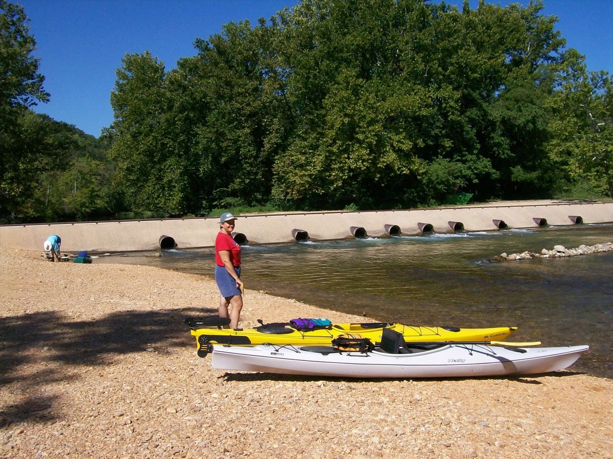
The dog days of August are perfect for escaping daily routines and making time for some R&R. Head to the beach, do some fishing, recline in the shade with a good book... there are countless ways to slow down the pace of life and enjoy the outdoors before another summer fades into fall. After several consecutive weeks of unrelenting extreme heat and humidity, the return to normal temperatures was a welcome relief. A cool front came through a few days ago and brought with it some delightful weather. That's all the prodding my wife and I needed to dust off the kayaks and plan a float trip down one of our local rivers.

South-central Missouri is somewhat of a paddling mecca. Folks come from far and wide to patronize the dozens of rental / livery services that get you equipped and on the water for a fee. As you might expect, there is very good reason for this popularity. The area has some of the most incredible scenery to be had anywhere in the country. Indeed, the US National Park Service oversees sections of both the Current and Jack's Fork Rivers as a means to protect the natural beauty found along their banks. You can click on the photo below for a larger view or go HERE for a downloadable hi-res pdf map of the area.


With 150 or so navigable miles of river to choose from
within a 30-minute drive, the next question becomes which section(s) to do first. Alley Spring is one of the prettiest and most interesting places we have seen since moving here a little over a year ago. In addition to the spring itself which has an average daily flow of 81 MILLION gallons per day, one will find a 100+ year-old mill, hiking trails, a picnic area, and a campground. Our familiarity with Alley made it a natural choice so we paddled the section from there to the town of Eminence. Why had we waited so many months before making time to paddle? The scenery was simply awesome. Unfortunately we had no camera along on that trip, but those few hours on the water is all it took to rekindle the paddling bug. We promised ourselves we would do it again very soon.

Providentially, we recently met a local couple who are also avid kayakers. They have extensive experience with these local streams and graciously offered to "show us around". Al and Pam are great folks from New Orleans who chose to retire in Missouri primarily because of their fondness for the local waterways... our kinda people! It didn't take long before a plan was hatched and we were sharing adventures together. The pictures that follow are from the second and third trips we did with them. Don't forget that you can click on any of the pictures for a full-sized image.


ready, set, ....go!


The stretch of the Current River described herein begins at the Cedar Grove put-in near the tiny town of Jadwin. Dent County road ZZ ends right at the river. Yes, that's double Z as in zebra. They use letters instead of numbers to label some of the roads here in Missouri. :)   Our takeout point the first day was at Welch Landing which is a short distance off County Road K near Aker's Ferry.  Our put-in the second day was at Akers and our takeout was at the Pulltite rec area located at the end of County Road EE.


just another bluff


Portions of this river route are very canyon-esque. Vertical rock walls rising straight out of the riverbed are common on the Current and Jack's Fork. There are also more than 6000 caves in Missouri with a high concentration of them in this particular area due to the karst topography of the region. Some of these are accessible directly from the river.


vanilla, cherry, lemon, or lime?


These yakkers are a colorful bunch, aren't they? Polyethylene is a wonderful thing! I thank God for making all those Tyrannosaurus Rexes every time I slip into my sleek, waterproof, incredibly durable kayak. :)


our tourguides


Speaking of Divine Providence, our newfound friends Al and Pam are graciously showing us the best places to go and the many hidden treasures along the way that we would otherwise paddle right past. We thoroughly enjoy their company and look forward to many more float trips together.


"RIVER RIGHT !!"


Case in point, here they are leading us through one set of particularly treacherous rapids. Just kidding... I don't think there is even a single "class 2" rapid to be found on these rivers except perhaps in early spring or immediately after a heavy rain. The turbulence in the photo above is being generated by Welch Spring which adds an average of 105 million gallons of water per day to the Current River's flow. We all took turns "surfing" the twelve-inch waves.


a pleasant surprise


We unexpectedly got an up close and personal view of an American Bald Eagle on this trip. He/She remained still for the camera as we glided quietly 20 feet below his/her perch. I've watched the live nest-cam feeds that are available on the web, but this is the closest I've ever been to one in real life. Pretty awesome!


a pretty sight


Horseback riding is another way to enjoy the beauty of the Ozarks.  People come from all over tarnation to participate in organized trail rides and pack trips up to a week long.  The folks in the picture were locals just out for a Sunday jaunt close to home.  There are also two herds of wild horses that wander free in the area.  We hope to encounter them along the river someday.


young buck with no fear


I was sure this whitetail would bolt as we approached but he seemed as interested in us as we were in him.  We glided past only thirty feet from this handsome fella.


Caves are cool !  Caves that you can paddle right into are even cooler!  This one was simply amazing.  Once beyond the mouth it opens into a large cavern.  As you can see in these pictures there was plenty of room inside for all four of our boats.


there's no place he'd rather be


So that's it for this installment. Hopefully I'll be able to add more interesting stories and pictures in the coming weeks and months. Stay tuned!

Monday, May 12, 2008

Section Hiking in Rocksylvania


Ahhhh, spring. Winter's grip on NJ is finally broken. Break out the t-shirts and shorts. Watch as the landscape gets a bit greener each day. Plan the next outdoor adventure.

Living so close to the famed Appalachian Trail, it inevitably acts like a magnet for those of us who are familiar with its pleasures. As soon as the mercury begins topping 60 degrees on a regular basis, we can feel it beckoning us to return and tread its well-worn path. Of course this year is no different than any other in that regard, so when the son of family friends informed me that he was going to be spending several days on the trail with some of his college buddies and invited me to come along, I jumped at the opportunity.

When "the plan" was revealed to me just prior to the trip's start, my first reaction was that 16-18 miles per day sounded like a bit much. I knew from previous experience that this particular stretch was no stroll in the park. The AT in Pennsylvania is well known among hikers as an extremely rocky portion of the 2175 mile trail. There are some sections where it seems you go for miles without your feet touching one square inch of soil. When you DO come to the occasional patch of "normal" trail, your battered soles breathe a sigh of relief, but these segments are teasingly short-lived. On the other hand, the added stress placed on one's lower body by this part of the trail is just another challenge to be overcome by those who are not easily discouraged.

imagine mile after mile of this

Still, 18 mile days are always l-o-n-g days of walking with precious little time for an afternoon nap or other diversion. Could this 54 year-old guy still do that kind of mileage? And not knowing how experienced the others were, I even had my doubts whether everyone in this group would be able to handle that much distance per day. So, feeling obligated to at least note my opinion, I sent my concerns via email to Bill, the only one in the group who I knew personally. I was fully expecting to be ignored by the invincible young bucks, which is pretty much what happened. Don't get me wrong... I didn't mind at all, and I would have done the same in their position. This was THEIR trip, not mine. I was just the old guy who would be tagging along and probably slowing everybody down. Although I am often the one cast in the role of trip planner, that responsibility was being shouldered by someone else this time and I was actually grateful that I did not have to partake in the decision making process. I suppose that was part of the appeal for me... I didn't have to do anything but grab my pack and show up. If I couldn't handle it, then I'd simply hike at whatever pace I felt comfortable. I am no stranger to solo treks, and my pack always includes everything I need to be fully self-sufficient for the duration of any adventure. I was fully aware of and prepared for the possibility that I wouldn't see them the entire four days. Also, on some masochistic level I guess I looked forward to finding out how much punishment the old bod could still take.
The others began their hike on a Sunday afternoon in Wind Gap, which coincides with the beginning of section 2 of the trail according to the official Appalachian Trail Guide. They hiked about 4 miles in to the Leroy Smith shelter and spent the night there. The next day they walked their first full day, doing a grueling 17+ miles and ending up at the Outerbridge shelter. This is where I caught up with them. My wife dropped me off Monday evening at the junction of the trail and route 873 in Lehigh Gap and I hiked the 7/10ths of a mile up to the lean-to they had claimed for the night. I met the other two members of this expedition for the first time, Tyler and Patrick, both likable fellows.


signage
After the introductions and some small talk, I continued to follow the white blazes in the diminishing light and then swung onto the North Trail, a blue-blazed path that parallels the main route but is far more scenic. I made my way up to the ridge and emerged out onto a bald overlooking the Lehigh River Valley. The sun had just set so I pulled the camera out to record the moment. Don't forget to click on the pictures to enlarge them!
view from the top

I wandered around for the next twenty minutes or so enjoying the vista and looking for a place to set up camp. There were only a few scraggly trees that had managed to take root out on this exposed summit, so finding two appropriately sized and spaced trunks proved difficult. I could have easily found something suitable at the edge of the bald but preferred, if possible, to set up where I could enjoy the incredible 270-degree view from my hammock. Eventually I located what I wanted and strung up my perch for the night. After hanging my food nearby and changing out of my shorts, I stretched out on one of the bigger rocks that was still warm from soaking up the sun's rays all day. By this time it was completely dark and the lights of civilization were twinkling in the distance. I love campsites like this, they're always the highlight of any trip for me... very conducive to introspection and prayer. I sat quietly for nearly two hours gazing out over the surrounding landscape while enjoying my bedtime snack.

stealthin' it

As soon as the sun broke above the top of the blue ridge the next morning, I was up and about. I made my usual oatmeal breakfast, packed up, and prepared to move on. First, though, I made a little side trip down to "Devil's Pulpit" to see if the view from there was any better. It wasn't, but it made for a nice half-mile (round-trip) leg-stretch. I grabbed my pack and headed southwest, leaving my campsite at precisely 8:45am.

tuesday morning

the magical levitating food bags

pioneer spirit?


i'm sure there's a story about this place

The North Trail stays out on the exposed ridge for the next couple of miles, so there were many good views. I saw a wild turkey scurry into the brush when I startled it. Bill, who followed this same route a couple of hours later, actually got to see a bear feeding along this section. Somewhere around the 2.5 mile mark, this blue-blazed trail turns back into the woods and rejoins the AT. Around noon I came to Bake Oven Knob shelter, a smallish, older lean-to with water nearby. I tanked up, left a note for the others, and headed on.

just passin' thru

The actual summit of Bake Oven Knob was a mile or so farther and offered a decent view. I stopped for a snack a short time after that along a power cut, then plodded on for another four miles and had a hot lunch up on Baer Rocks, another overlook. Next it was down to the Rt. 309 road crossing which marks the end of section three, then up the other side. Another four miles of fairly level walking brought me finally to the Allentown shelter, the group's pre-determined destination for this day. It was exactly 6pm when I arrived at the empty hut and I wondered how long it would be before the boys would show up. It had been an 18 mile day, plus or minus a few tenths, and I was exhausted. But I had done it! I recalled how a decade ago my wife and I had done 15 of those miles over the course of TWO days, and I had just accomplished 20% more distance in only ONE day. Yeee-haaaa!

now THAT'S a nice shelter!

My reveling was brief... Tyler and Bill showed up a mere ten minutes after me. Then I found out they had started more than two hours later than I did that morning! Pffffffffffft. Back to reality. But... but... they're at their physical prime. Plus I took a full hour for lunch while they took barely twenty minutes by their accounting. Anyway, we were all glad that we were done for the day. Patrick rolled in about an hour later, we ate dinner, then sat around comparing notes as the last light faded.

this is what "five bars" looks like


Speaking of notes, one point I thoroughly enjoyed making repeatedly on this trip concerns footwear. You see, after I cut some ten pounds from from my total pack weight last year, I discovered that I can now wear regular old sneakers on the trail instead of boots. I tried this for the first time last fall on a similar hike and knew from that experience that I could safely leave my vibram soles at home and travel in my comfortable everyday sneaks, plus I didn't need to bring a second pair of "around camp shoes", which further decreased my pack weight. Predictably, however, my bright white $12 K-Mart specials sometimes drew snickers from other hikers. In a setting where gear comparisons and pride in one's equipment runs higher than average, I'm sure many false assumptions were made regarding my level of backcountry knowledge and expertise as a result of this choice. But hopefully a few pre-conceived notions (likely derived from manufacturers' "need-generating" glossy ad pages) have been called into question by cold, hard, real-life observations. The interesting thing (for me) on this particular trip was that, of the four of us, I was the only one who never got even one blister. Indeed, I had the last laugh watching the others perform their nightly foot care routine.

go ahead, laugh it up suckers! :-)

The next morning I slept later than usual and barely got out of camp before the sleepyheads. Patrick hit the trail first and I left a few minutes behind him.
some of us claimed to "need" more sleep than others


at least one of 'em knows when to GET UP!

It was gonna be another big-mileage day, so I kept a brisk pace and took few breaks. As a matter of fact, I didn't rest at all until I got to Dan's Pulpit around noon.
Patrick showed up about 10 minutes later. He had taken a short side trail up to Tri-County Corner and we figured that must be where I unknowingly passed him. After a 15-minute break here, he, then I, resumed our trek. I caught up with him a while later at a bridge over a good-sized stream. It was here that I learned of Eckville shelter which was not mentioned in my circa 1980 guidebook, but WAS in his. It seemed like a good lunch destination and it was only a half mile ahead, so I left him soaking his feet in the cool water and took the lead once again.
panther creek, "always flowing"

Patrick's guidebook indicated that the Eckville shelter was one of those that had a "caretaker", and even more of interest to a dirty, sweaty hiker, a SHOWER. I wasn't there but two minutes and I had my towel, washcloth, and soap out of my pack and was headed for the little outbuilding. Man, did that cold water feel good! As I sat at the breezy picnic table eating my peanut-buttered bagels, the others strolled up. Evidently, the prospect of a refreshing shower wasn't as appealing to the rest of the gang. They just snacked and rested a bit before we all resumed our journey back up to the ridge.

one of the few AT shelters with flush toilets and showers


The caretaker had assured us that it was an easy hike up to "The Pinnacle", billed as the best view to be had on the entire AT in Pennsylvania. He was right that the route was mainly along an old mountain road, but the relentless uphill that went on for hours made the task brutal. With the others safely out of earshot way ahead of me, sometime during the third hour of this long ascent I began to hallucinate and pester myself verbally, "...are we there yet? are we there yet? are we almost there? how much longer till we get there?..." Just as I was concluding that there was something unnatural going on and this trail would never get to the top of anything, I was assured by a hiker traveling in the opposite direction that "it" was only another quarter mile or so ahead. "Yeah, sure... that's what I told me about an hour ago", I muttered to myself after he had passed.

Eventually there was indeed such a place as The Pinnacle and the view was very nice. Even better was the breeze that offered some welcome relief from the persistent gnats and helped evaporate some of the new sweat which had accumulated since my shower at Eckville. Bill and Tyler were here, having arrived at least 20 minutes before me, and they were cooking up some mac and cheese. Patrick had opted to take a blue-blazed shortcut which eliminated a few miles of walking, including this overlook. The others packed up and moseyed off, headed for their last campsite of this trip, the Windsor Furnace shelter.

refueling stop


suspicious-looking character

Inclined to avoid sleeping at shelters whenever possible, I stopped a mile or so before Windsor Furnace at a place called Pulpit Rock. (Those Keystoners sure have a penchant for naming places, don't they?) I like to camp on high ground and preferably where there is a view. Shelters rarely have one since the primary factor in selecting a site for building one is, logically enough, the availability of water, and you won't find many springs up on the ridgeline. There is also the relative lack of privacy at shelters, combined with the fact that I am now a confirmed "hanger", preferring to sleep suspended in a hammock rather than on the ground or even the smooth floor of a lean-to. Anyway, I found a suitable spot not far off the trail to pitch my rig, grabbed some food, my phone, and a pint of water, and laid out on the slab of stone to enjoy the view and call home. My wife and I talked for over two and a half hours. She caught me up on the latest weather forecast and checked out some pictures taken previously by others from this remote location which are available through google earth. Of course my view was at nighttime which looks much different from the daytime version. Still, it was
nice that she could get an idea of what I was seeing. She told me there was a chance of rain before daybreak, so before retiring I pitched my tarp above the hammock for the first time this trip. It was a warm night and I hardly even needed my sleeping bag.

I awoke at first light to the patter of rain on the tarp, so it was a good thing I got the updated forecast the night before. Everything was completely dry under my 12 foot by 10 foot waterproof shield, so I was able to pack up without getting wet at all. My hammock system is designed for very fast setup and break-down, employing straps, cords, and carabiners with lightweight, quick-adjust hardware. I can have my hammock out of its stuff sack and fully deployed in about a minute (without hurrying at all). Prolly half that if I tried to do it fast. Break-down takes only slightly longer... basically as quick as I can re-stuff it. The tarp goes up and down with similar ease, and I only use it if there is the possibility of precipitation.

Using google's satellite view
before departing on this trip, I had discovered a network of access roads in this area that passed very close to both my campsite and the shelter where the rest of the crew spent the night. When I departed my camp Thursday morning, I decided to travel the mile between my location and the Windsor Furnace shelter on these roads and see what there was to see. I arrived at the shelter a short time later at 7:45am. After using the privy located there, I headed off on this last stretch of trail between us and Bill's Jeep which was parked in Port Clinton. Tyler and Bill caught up and passed me a couple of miles before the road. After they sailed by, I picked up my pace enough to keep them in sight until we finished up around 10:30am. They jumped in the Schuylkill River to cool down and clean up, while I chose instead to take a rubbing-alcohol "spit bath" to accomplish the same. By the time we three were done with our respective personal hygiene and refreshment, Patrick rolled in and we drove away, another memorable hiking adventure behind us.

Thanks to all the guys for making this an enjoyable trip, especially Tyler for putting it together and Bill for the invitation and ride home.

Monday, October 29, 2007

The Timp

Way back in the spring, my youngest daughter Sarah began asking me when we were going to make our annual trek to "The Timp". It was about ten years ago that I had first taken her and her siblings to this place which for me (and evidently her as well) has special memories attached to it. It has since become a tradition for us to make a yearly visit to Harriman State Park near the NJ / NY border and backpack up the steep three mile trail to the top of this modest 1000 foot high "mountain" and camp. Events conspired to prevent us from making the trip earlier this year, and then the heat of summer was upon us, but once the weather turned cooler again, she (bless her heart) resumed her prompting. The trip was finally scheduled for the last weekend in October, weather permitting. We put the news out to a few other people we thought would enjoy accompanying us on the hike, and they made plans to join us.

After several consecutive weekends of absolutely perfect weather, I guess you could say we were due for a bad one. Sure enough, a frontal system stalled over our area ju
st in time to cast doubt as to whether we would have to cancel the trip. Every day last week I flipped through half a dozen weather websites looking for any encouraging prediction but found none. On Wednesday the forecast was calling for rain on both Saturday and Sunday. On Thursday night my wife and I were at the grocery store picking up some last minute items for the trip just in case something changed. By coincidence we bumped into a friend who was one of the few we had invited to come along and he informed us that he and his wife had decided to cancel. I couldn't blame him... who in their right mind would leave the comfort of their home to spend two days and a night in the cold, wet woods? On the other hand, this trip had already been postponed several times, and with the end of the 2007 camping season near, I was inclined to cancel this trip only if it looked like a total washout. Unfortunately, that was the way it would be if the people who make their living predicting the weather were correct.

Science had been my favorite subject in school. It was one of the few classes that had my full attention and where I actually learned anything that I considered useful. Not surprisingly then, I have always found meteorology very interesting
. Understanding how the whole hydrologic cycle works can give one a better appreciation for the intricacies of our planet, at least in my opinion. Anyway, I had to remind myself that the purpose of this trip was to have fun, not to study the different types of air masses and how they interact with one another. If it rained the whole time, it would NOT be fun for anyone (with one possible exception). On the other hand, if it cleared up right around the time we got to the top of the mountain, THAT had the potential to be spectacular and maybe even enhance the adventure.

Not surprisingly, the night before our scheduled departure people were calling to find out if the trip was still on. After accessing the detailed data on the government's NOAA website and making my own analysis, I came to the somewhat optimistic conclusion that it was a good bet the precipitation would end right around the time we planned to begin walking (2pm) and it might even dry out before we reached the top. I suspect that everyone had their doubts about the accuracy of my un-edjumacated opinion. I know I did. Luckily for me and my pride this is exactly how the day played out.

We assembled around mid morning on Saturday and ran through the last minute checklists. It was raining heavily as the eight of us threw our loaded packs in the vehicles and drove north toward the park. Around 1pm we stopped for lunch along the way. It was still raining hard with no signs of letting up any time soon. Around 2pm we pulled into the parking lot near the trailhead. It was STILL raining, although the sky had begun to lighten up. We strapped on our packs, put our ponchos on, and began our ascent, becoming more confident with each step that this three-day-long deluge might finally be coming to an end. It was hardly five minutes up the hill that people began removing their rain gear. Shortly after that, the jackets and sweatshirts came off. As it turned out, all the extra clothes we brought to make sure we had something dry to wear were reduced to unnecessary cargo. We plodded up the steep incline and made our way ever higher. Even with several rest stops, the miles seemed to go by faster than expected. As we neared the top, blue sky patches appeared through the canopy of trees. By the time we finally reached the rocky summit, the sun had emerged! We dropped our packs and stood on the highest point to enjoy the incredible view. To the west and overhead was now clear, while the dark mass of clouds that had dropped over three inches of rain was being ushered quickly eastward by a stiff wind. As the trip planner, I could now breathe a sigh of relief that I had not dragged everyone up here only to spend a miserable wet night in the woods. Don't forget you can click on the pictures to see the full-screen version.

pre-departure

five minutes later

the top of the timp

Pepper's sixth (and possibly last) Timp trip

looks dangerous, donit?

We savored the view for awhile, then our group reassembled just below the peak to select suitable tent sites. Everyone took part in this process and since most of us had been through this routine before, it went without a hitch. Next, a few of us went off to seek the driest firewood available, while others went off to filter water. Camp chores done, we then made the short 100 foot walk back to the top to watch the beautiful sunset. I think everyone was glad that we hadn't called the whole trip off.


a view even a dog can appreciate

the water gathering ritual

Angela inspects the picture she just took


looking west from camp just after sunset

The wind was blowing something fierce. It doesn't take long for a gale to strip heat from one's body, so after watching the orb dip below the horizon, we once again retreated to the somewhat protected hollow where we had established camp. We prepared and ate our meal, cleaned up some of the dishes, then I summoned everyone back to the top of the mountain to view an an event which was about to take place in the sky over our heads. As I said, I am something of a science buff, so while surfing the net recently I stumbled upon a website where I discovered something called "iridium flares". Intrigued, I learned that there are at present 66 active communication satellites whose highly polished antennae reflect sunlight like giant mirrors in space and because of their fixed axis in relation to the earth's surface, it can also be predicted when and where this reflection can be observed and what level of magnitude (brightness) you can expect at any location on the globe. The flares first appear like a dim star that quickly becomes very bright, then just as quickly fades back to invisibility. The whole thing lasts only about 20 or 30 seconds so unless you are looking for it, chances are you will never notice one. While the trip was still in it's planning stage, I used google earth to determine the geographical coordinates of "The Timp", then plugged this information into the website that maintains the schedule for the flares. Fortunately, I found there was going to be not only one but TWO of them visible from our campsite on the Saturday night we would be there, spaced only four minutes apart! From our vantage point I knew we would have an unobstructed view of the sky as long as there was no cloud cover. So there we were, all eight of us casting our gaze to the north-northeast and focused on an area in the heavens between the star Polaris and the constellation Cassiopeia at precisely 7:44:52pm. As promised, the flares did indeed occur and we all got our first-ever viewing of this phenomenon, along with a little astronomy lesson.

Now it was time to set about the work of getting a fire going. As you might guess, this was no small task. Fortunately, Dave had the brilliant idea to grab a newspaper at lunchtime for the purpose of helping us to get the wet wood burning. It took longer than usual and a lot of coaxing, but eventually man prevailed over the elements and got the thing lit. We then sat for hours bathing in its radiant heat... talking, telling stories, sipping hot chocolate, and joking with one another. Eventually we used up all the wood and it was time to crawl into our sleeping bags for the night.

even drenched wood burns with enough coaxing


Normally my wife and I would prefer to sleep out under the stars on the summit since this was a clear, bugless night. However, the strong wind buffeting the treetops had not relented at all, and if anything, had increased. The tents were nestled in an area among trees and were surrounded on all sides by a twenty foot high ridge. The wind was so intense that even in this protected space it was causing the tent walls to flap noisily. This racket got progressively worse after midnight and peaked sometime around 3am. I know this because the tarp covering my hammock was making the most noise of all and woke me up repeatedly during the night. I am sure that there were gusts approaching 50mph at times. This was the trial run for my new shelter which I hoped would prove to be a good replacement for a tent. Except for the noisy fabric (which was only a factor because of the extreme wind conditions), the hammock passed the test with flying colors. Not only was I much more comfortable suspended above the hard ground, but I was also very warm ensconced in this cleverly designed cocoon. I would also bet that if I had tightened the guy lines that secure the tarp, I could have alleviated some of the snapping.

We awoke to a 40 degree sunny morning. The wind had subsided to about 15mph by daybreak. One by one we mustered the courage to slip out of our bags and brave the chilly air. We found a quiet spot in the lee of some rocks to boil water for our oatmeal breakfast. After that we broke camp and prepared for our return voyage to the parking lot. Before heading off, I whipped out my GPS device and sent the teenagers on a quest to find a geocache that someone else had hidden somewhere near the top of the mountain. For the uninitiated, "geocaching" is a hobby of sorts where people hide small containers and then place information about the stash on the internet. There is a website where you can find information about these hidden containers. You just put in the coordinates of any location and it gives you the latitude and longitude numbers for each nearby cache, who hid them, and a host of other interesting facts. It took the kids about ten minutes, but they located the one I had printed out for them to find. As is the custom, we were allowed to take one item from the box as long as we left one in exchange. Patrick claimed the red bandanna and offered a stick of gum as his swap. Not a fair trade in my opinion but who am I to judge? :-)

a crisp, clear, 40 degree Sunday morning

unquestionably the most colorful member of our group

leaving no trace

Finally underway just after noon, we followed the red-dot blazes that would lead us back down to the road by a different route. This trail took us over Bald Mountain where we paused for lunch around 1:30pm. The temperature had warmed up to around 60 by then, but the breeze made it feel much cooler, especially whenever the sun was blocked by a cumulus cloud, which seemed to be most of the time. Nevertheless, we enjoyed our break on a slab of rock which had actually become warm to the touch from absorbing the sun's rays all morning.

breaktime


We cleaned up so as to leave no trace of our presence there and continued along. Just a few minutes farther down the trail we came to a dramatic view from the edge of a cliff. Actually, only Dave and myself got to see the incredible sight because the others who were all ahead of us either didn't notice or opted to skip the little side trail that led to it. We had a awesome view of Bear Mountain Bridge and the upsteam waters of the Hudson for miles above it. Although some in our group were now complaining about the added distance back to the bottom, others among us were thoroughly enjoying this very scenic trail. There were many fine views to the east that are not afforded along the trail we came up on the day before.

my new wallpaper

our animule

Dave finally accepts that (pack) size DOES matter

pepper acting as chaperone

the ubiquitous cell phone: we had at least 7 among us


When we were about a mile and a half from the bottom, Dave and I were again lingering at a viewpoint when we were approached by a young woman who turned out to be a "trail angel". For those who have never heard of trail angels, they are people you meet along the way that offer some unexpected help. I don't think giving directions counts, but more tangible assistance like food or equipment would certainly qualify. In our case, we were coming down the mountain to a different spot along the road than where our vehicles were parked. This meant that at least one of us had to walk or jog along the road for about a mile to retrieve a car or truck. I had volunteered to do this since I was the one who had suggested this alternate route down. But now, as we neared the end of our journey, we were offered a ride by this friendly stranger. This would save our group about 30 minutes of waiting time. Multiplied by the number of our group (not including the dog) and this cumulatively saved us over four hours! Anyway, assisted by this angel I was able to shuttle my van back to the new parking lot before any of the others even got to the end of the trail, so there was no lost time at all.

All in all, it was another successful trip. As far as I could tell, everyone enjoyed themselves. Not only did we maintain a family tradition... but we also learned new things, tried out some new equipment, walked some new trails, and established some new relationships. My wife and I wish to thank all those who contributed to making this adventure what it was.


back down, safe and sound