As the
name implies, the Tahoe Rim Trail (TRT) traverses the mountainous
terrain that surrounds Lake Tahoe. It is a loop trail with several
access points, so it can be hiked in sections or in its entirety. My
wife and I decided to attempt all 170 miles in one shot since this
region of the US is 2000 miles from our home in southern Missouri and
traveling that distance entails considerable time and expense just to
get there. Plus, we hadn't taken a vacation in years, we're
both getting on in age (mid 60's), and as the saying goes, we
may never pass this way again.
Some
interesting facts about Lake Tahoe: The lake itself straddles the
California – Nevada border. It is the largest alpine lake in
North America, and in terms of volume it ranks sixth after the five
Great Lakes. At 1645 feet deep it is the second deepest lake in the
US; only Crater Lake in Oregon is deeper. The elevation at the lake's surface is 6225 feet. There are 63 streams which drain into the lake
and one outlet, the Truckee River. A small dam in Tahoe City regulates the
outflow and thereby maintains the level of the lake fairly constant.

Some
interesting facts about the Tahoe Rim Trail: Roughly two-thirds of the 170
miles which comprise the TRT loop are in California's famed Sierra
Nevada Mountain Range, with the remaining eastern third residing in Nevada's Carson Range, which is considered a spur of the Sierras. The TRT
also shares about 50 miles with the much longer Pacific Crest Trail
(PCT) as the merged routes pass through the rugged Desolation
Wilderness. First proposed in 1978, the trail was completed in 2001.
The elevation of the trail ranges from 6240 feet at the bridge
crossing of the Truckee River, to 10,338 feet on Relay Peak. There
are also short spur trails which ascend Mt. Rose (10,785 feet),
Freel Peak (10,891 feet), and several other mountains in the 9-10k
range.
The
climate in the region is very pleasant with warm, dry summers and low
humidity. Most of the area's precipitation falls as snow during the
winter months, and several nearby ski resorts make Tahoe an
attractive tourist destination year-round. The average high
temperature in August is 79 degrees, with the average low around 50F.
According to what I've read, the best time to hike the TRT is from
mid-July through September. By that time the trail is usually clear
of snow and the stream crossings manageable.
The
nearest major airport access is in Reno, Nevada, and there are
shuttles that can get you from there to Tahoe City for about fifty bucks per person. After careful consideration, my wife and I
opted to drive out instead of fly. This way we avoided the
ridiculous TSA restrictions AND had the opportunity to see some beautiful scenery along the way. Besides, you're never too old
to enjoy a Great American Road Trip! We allowed three days out and four days back which added a full week to our master plan. This
worked out very well as you will see in the descriptions below.
Although
we didn't actually start hiking until August 20th, our
adventure really began on August 17th when we hit the road. We are both
confirmed penny-pinchers, so neither of us had a problem trying to
minimize expenses on this journey. As part of the planning process,
my wife extensively researched free and nearly-free places to
camp as we made our way west. Our vehicle is a mid-sized sedan, so
boondocking in Wal-mart parking lots was not a viable option. As it
turns out, there are a plethora of places to camp for free,
especially in the western half of the country.
At the
end of the first day of traveling we found ourselves at exit 222 on Interstate 80 and
the small town of Cozad, Nebraska. Adjacent to the highway was “Cozad Lake” which is part of a Wildlife Management Area. Free overnight
camping is permitted at sites around the perimeter of the lake. We
scoped it out and determined that it looked safe, found a site with a
few appropriately-spaced trees (we're both primarily hammock campers, but had a tent with us just in case), then skedaddled into town for dinner
at “El Paraiso”, a small Mexican food establishment. We returned
just before dark to set up our hammocks. There were two or three
other occupied sites by this time, but our preferred site was still
available. Since the lake is literally right next to the freeway we
could hear the traffic noise, but hey... you can't have everything.
Or can you? Read on! Actually, the noise wasn't a problem at all
and served to lull us both to sleep quickly.

Cozad
WMA
Just
after daybreak we packed up and continued westbound on I-80. An hour
or two down the road we stopped at a rest area near Sidney, Nebraska
for breakfast. Knowing we wouldn't return home for at least three weeks
when we left the previous day, we had emptied the fridge of all
perishable food and brought it with us in a cooler. We also brought a small car-camping butane stove with us and a cast iron skillet.
Omelettes hit the spot and saved us a few bucks on restaurant food as well. This
particular rest area was one of the nicest I have ever seen with lush
lawns, sweeping views, well-maintained picnic tables, and impeccable
landscaping. I couldn't imagine a nicer place to have a meal at any
price, let alone for free! Later in the day, lunch was fruit while
underway as the miles ticked by.

Sidney,
Nebraska Rest Area, 5 stars
One
nice thing about driving out west (besides the dramatic scenery) is
the higher speed limits. In addition to the 80 MPH signs on some of the
interstate highways, we also encountered some two-lane secondary
roads with a 70 MPH limit. This was particularly amusing to me on some sections of US
95 in Nevada because the only vehicles traveling less than 80 were
large RVs and those towing trailers. Everyone else was passing these
"slowpokes" and cruising at 90+ when unimpeded. And why not
when you can see for 10 miles in all directions on the flat, barren
landscape? Enforcement was zero, by the way. Which is not so
surprising given that not long ago some western states had no set
speed limits during daylight hours. The signs used to say
“reasonable and prudent”. Some of you older folks may remember
those days.

that's more like it

In case we had any doubt where we were...
At the
end of the second travel day we were near the Utah/Nevada border.
Many of you have probably heard of the Bonneville Salt Flats. It's
where people go when attempting to set land speed records in various
types of vehicles. Each summer they have “speed week” at the
flats, and as it turned out this event had concluded just a few days
prior to our arrival in the area so the crowds were gone. To
describe this area as desolate would be an understatement. Does that
make it safer or less-safe for overnight camping? We were definitely
out of our “southern
comfort zone” in this harsh environment, but decided to give it
a go. But first we had to find dinner. About 5 miles away was the
border town of West Wendover, Nevada. In small-town casinos you can
sometimes find good food at a bargain price and we hit paydirt at the
“Red Garter Casino”. Inside, past the array of one-armed bandits,
was “The Italia Ristorante”. A full course salmon dinner with
large garden salad and bread in a tourist town for twelve bucks? You
betcha!
With our appetites sated, we headed back to the edge of the
salt flats. As you might imagine, the salt flats and its environs
are devoid of trees, so how does one hang a hammock in such a place?
As they say, where there's a will there's a way. We found a large
sign with two sturdy posts in an otherwise-empty area, literally the
middle of nowhere. That served as one anchor point, and the doorjamb
of our little car served as the other. Perfect! We were several
miles off the highway so there was no traffic noise at all, and with
the waning gibbous moon not scheduled to rise until after 10pm, the
stargazing at bedtime was amazing. My phone's camera doesn't perform
well in low light conditions, so you'll have to trust me on that one.

No Trees? No Problem!
The
next morning we reluctantly moved on after agreeing that we must
re-visit this place in the future when we have more time to explore.
Breakfast was again at a rest area along the way where we finished
off the last of the eggs and veggies. This one was near exit 373 on
I-80 in Eastern Nevada.

Pequot
Rest Area near Wells, Nevada
By
lunchtime we had made it to Lake Tahoe, specifically the hamlet of
Incline Village. Before departure from home we had packed up four
re-supply boxes with food and other sundry items that we would need
to retrieve at various points along the trail. The first planned re-supply
point was the Incline Village Post Office, so we stopped there and
mailed a box to ourselves, via general delivery. The cost was
$12.30. A little steep for a package that didn't even need to leave
the building, but this was the only re-supply that we would have to
pay for. Conveniently located next to the post office was Big Foot
Deli which had a nice lunch menu and outdoor seating. After lunch we headed south along
the eastern shore to the Spooner North Trailhead on US 50. The
eastern side of Lake Tahoe is notoriously dry, receiving only half
the annual precipitation as the western side. This makes for some
long stretches of trail between water sources, sometimes approaching
20 miles. In order to later avoid a 2-mile round-trip off-trail slog to Spooner
Lake, we decided to cache water near this trailhead, two full gallons
of the stuff. Next we continued south to South Lake Tahoe (SLT)
where we planned to spend this night, as well as two more nights when
we came off the trail in the coming days to re-supply. First we
dropped re-supply box #3 at an AirBnB hosted by “Randy” (more about him
later). He graciously accepted the box and held it for over a week
while we hiked the trail. The next stop was the USFS office to obtain our permits for entering the Desolation
Wilderness eight days later. Normally there is a quota system that
limits access to this area, however the quota doesn't apply to TRT
thru-hikers, with the stipulation that they stay within 300 feet of the
trail (no side excursions). We picked our expected dates to enter
and exit the area, held our noses while paying the $26 fee, and
headed for our final destination of the night... AirBnB #1 in SLT.
After checking in, showering, and packing our backpacks for the
following day, we walked around the corner to a small Mexican eatery
for dinner. This AirBnB was also going to be our overnight
accommodation six days later, as well as our second re-supply point,
so we finished packing re-supply box #2 and gave it to the property owner for
safe-keeping.
We woke
up early the next morning, anxious to begin our long-anticipated
backpacking trip. After driving around the western side of the lake,
we arrived in Tahoe City (our fourth and final resupply point) around
8am. We stopped at Rosie's Cafe for breakfast. While their food was
decent, the prices were outrageous, even for a tourist town. Nothing about the food,
service, or location justified these prices, but unfortunately Rosie's was
the only game in town that we could find which was open before 10am.
After breakfast we dropped off the aforementioned 4th
re-supply box at Alpenglow Sports. This is a good place to pick up
any last minute backpacking gear or clothing you might need, and
they hold hiker boxes for free. Finally, we drove another 12
miles to the Brockway Trailhead on CA 267 and
parked.
Day 1:
We hit the trail at 11:15am. The TRT route I downloaded into the
navigation app on my smartphone had mile markers on it, all 171 of
them, which made it easier to determine at a glance how many miles we
had ahead and behind us at any point on the trail. The arbitrary
trail terminus (MM 0) was the river crossing in Tahoe City, but as I
said, we were beginning our journey at Brockway which was at MM 20 on this map. The mile markers assume a clockwise direction of travel, and
conveniently that was our intent for this trip.
With a
late start, we planned a short day of only 7.5 miles. This would
allow us to slowly acclimate to the higher elevation while also letting us
gradually acquire our trail legs. My wife had done some day hikes
around home in the days and weeks before departure to train for this
trip, but I jumped in without any physical preparation whatsoever.
Who wants to exert themselves when it is 95 degrees outside with 95% humidity? No thanks!
Another factor from the get-go was that we were entering the driest
portion of the trail first which periodically required carrying four quarts of
water each, and we were planning on dry camping the first night on a
high ridge. For those who may not know how much a gallon of water
weighs, an easy way to remember it is with the little rhyme “a
pint's a pound the world around”. Eight pints to a gallon is
roughly eight pounds. Plus food. The general rule of thumb there is
1.5 to 2 pounds of food per person, per day. I was pretty close to
the higher number, while my wife was somewhere below the lower end of that range. So in my case I had 12 pounds of food and water to
start with, before adding all the backpacking gear. What was my "base weight" you might be wondering? Well as
much as I'd like to throw a ridiculously low number at you, the fact
is I can't afford much of the ultra-light gear. I'm moving in that
direction one piece of kit at a time, but it's a slow process. Plus,
overnight low temps in this region can easily dip below freezing even
in August so we had to be prepared for that. In fact, the predicted
low temp at lake level for this first night on the trail was 41-degrees. And everyone knows it's
colder the higher up you go, right? Well, as I discovered on this
trip, not necessarily. But who wants to risk a cold, miserable night
to save a few ounces? I own two sets of quilts, a zero set and a 40F
set. If I owned a 20-degree set, that's what I would have used. I
ended up choosing the zero top quilt and the 40-degree bottom quilt
as a compromise, which worked out just about right given the actual
temperatures we encountered. Yet another huge factor in our pack
weights was the presence of problem bears in this area. I normally
carry a bear bag kit (throw sack, mini-carabiner, and 50' of line) which weighs all of three ounces and has never
failed to protect my food from animals large or small. But our research prior to
departure made us aware that even people with Ursacks and good
hanging technique were having problems. So although canisters are not
required (yet) by the powers that be in this area, we opted to carry
them anyway to avoid any potential incidents. FYI, a BV-500 weighs
41 ounces... more than 2.5 pounds! Yes, it all adds up. So
with a full load of water and food my pack was somewhere in the 30-35 pound
range. Fortunately, this total weight dropped quickly as the water
and food was consumed. Just before a re-supply our total pack weight was
somewhere close to 20 pounds each. If curious, you can view a list
of each item I carried and their individual weights here:
https://lighterpack.com/r/7z1i1
Anyway...
back to the trail. It was mostly uphill for the first hour as we
climbed the switchbacks from the trailhead. It wasn't long before we
got our first awesome views which made hauling all that water weight
worth it. The trail itself was comprised of finely pulverized forest
duff with very few rocks or roots. I was wondering how in the world
this type of trail surface didn't wash away each time it rained, but
apparently it doesn't. The net result is the trail is extremely dusty.
This powder will coat your lower legs, infiltrate your shoes and
socks, and you will inhale a good bit of it as well. This is NOT a
complaint, just an observation. It was actually a very pleasant surface to
walk on, and very easy on the feet. Just plan on giving the
hiker in front of you some space. If you follow too closely, you
will literally eat their dust.
We
weren't expecting it, but there was a huge
butterfly migration in progress in this area. As we hiked along,
hundreds of butterflies streamed across our path, all headed in the
same general direction, obviously on a mission. This behavior seemed
odd to me until other hikers started asking if we had seen any
butterflies up on the ridge and told us about the phenomenon.
We had
a leisurely lunch mid-afternoon and made it to Mount Baldy at MM 27.5
in plenty of time to set up camp and cook dinner. The views from
this spot were fantastic. If you ever get the chance to hike the
TRT, try to spend a night here. Total mileage for the day was 7.5.
The elevation at camp was 9020' and the low temperature overnight was
49 degrees. There were plenty of trees for hammocks and flat ground
for tent dwellers. I'd rate this campsite 10/10.

View
from camp 1 on Mt. Baldy

Camp 1 on Mt. Baldy

Sunset from Camp 1
Day 2: We broke camp at 8:00am and stopped for breakfast within a mile at
another spot with long-range views. Our plan was for another easy,
short day of 7 miles which would put us at the top of Relay Peak for
the night. There was water at a spring a couple of miles before the
peak, so this dry camp wouldn't cost as much energy as the previous
night's lofty destination. It would also place us on the highest
point along the entire trail. But would there be trees above 10,000
feet? It turned out there were a few scrub trees at the top, but
nothing good to hang from. We could have backtracked slightly and
found something, or perhaps chose to cowboy-camp this night, but it
was only mid-afternoon when we got there and the wind was blowing
quite strong, so we decided to keep going. In another couple of
miles we came to a decent area, and while pitching our rigs we met a
young couple hiking in the opposite direction who told us that they
lost all their food (which was stored in an Ursack) to a bear the
previous night. The choice to carry the extra weight of bear
canisters was sounding more and more like a wise decision! This
couple had purchased new food and were also planning on camping on
Relay Peak this night, but after hearing our report of high winds at the top,
they chose to instead camp near us at MM 36.5. Total mileage for the day
was 9.0. The elevation at this point was 9365' and the low temp was
48 degrees. I'd rate this spot 7/10.
Day 3:
Broke camp at 8:25am after breakfast. Galena Falls at MM 37.7 was
very impressive. If we had gone a little farther the previous day we
would have had better views from our campsite, but it also might have
been more buggy. In any case, the falls was a good place to
replenish our water with some ice-cold snowmelt! Yes, we encountered
snow at several places along the trail. I had heard that all the
snow is usually gone by August but last winter was a record-breaking
snow season so this summer there was still a lot of the white stuff
around.

Beautiful
Galena Falls

How
to start a snowball fight in August
We
arrived at our first major road crossing, Mt. Rose Highway (aka NV
431) around 10:30am. The plan was to hitch a ride down to Incline
Village for lunch, retrieve our re-supply box from the Post Office,
hitch back to the trail, and then hike another 4 miles or so. I
used to thumb rides all the time as a teenager, but it had been decades
since I hitchhiked and my wife never had. Have times changed? Would
drivers stop to pick up old, scruffy-looking strangers? We
got our answer quickly because we got a ride within three minutes and
the driver took us all the way to the PO, arriving there before
11:00. We replenished the food in our bear canisters, topped off our
water bottles, decided it was too early for lunch, and headed back
toward the Mt. Rose Trailhead wondering if we'd be as lucky on the
return hitch. Since the Post Office was located on one of the smaller
streets in town, we had to walk almost a mile back to where the
highway began. Once there, we had another ride within 5 minutes and
this gentleman also brought us exactly where we needed to go, which
was actually beyond his own destination. Nice folks!
We were
back on-trail by 12:30. There was a stream crossing not far from the
road, Ophir Creek, where we stopped for lunch. Since the hitch went
so well, we were now ahead of schedule. After eating we took an hour
or so to do some laundry. It turns out that bear canisters are good
for more than just holding food. We emptied one of them and used it
as a mini washing machine. Of course we did this a good distance
from the creek so as not to pollute the water. A couple of rinse
cycles later and we were good to go. It's amazing how fast clothes
air dry when the humidity is around 25%.
As
part of our research of the area, I had read several trip reports
written by previous thru-hikers. One of these reports gave the
locations of all their campsites and rated them on a scale, which I
found particularly helpful and have decided to duplicate here. This
person did the entire loop in 10 days and we were planning on taking at
least 14, so only a few of their campsites would be potential targets
for us, but it was good intel just the same. One of these spots was
described as “nook with a view” which sounded intriguing and was
within range for tonight's camp. It took a little wandering around
to locate the exact spot, but this ended up being the best campsite
of the entire trip. Hidden from the TRT among a large pile of
boulders, it was very private, had an incredible view of Lake Tahoe,
and had three perfectly-spaced trees to boot! After pitching the hammocks, there was enough daylight left to sunbathe out on the rock ledge before
dinner. We stumbled upon a hidden geocache and were entertained by
the contents and the notes left by previous visitors. We cooked and
ate, then watched the sun dip below the horizon and
the stars come out. We lingered on the open ledge long after dark,
enjoying the moment. Does life get any better than this?
Total
mileage for the day was 9.1 including about a mile of road walking in
town. The elevation of this camp was 8840'. The low temp was 51
degrees with a light breeze wafting through the pines all night.
This site was easily 10/10++.

Camp 3 - “Nook with a View”

Sunset
from “The Nook”
Day
4: Woke up at 7:30 and broke camp at 9:40. There were many excellent views
both east and west on this section of trail. The water sources we
hoped were still flowing were not, and we walked all day without
coming upon any streams. Our destination for the evening was
Marlette Campground, one of only a few developed campgrounds along
the whole trail. We arrived there in the late afternoon with barely
a half liter of water apiece, but there was supposed to be a hydrant
here. The hydrant turned out to be broken, and we later heard it has
not worked for at least two years, even though signage in the area
still proclaims that water is available from it. I followed a dry
streambed downhill for quite a distance hoping to find a trickle, but
this was a waste of time and energy. Marlette Lake was about 2 miles
away on a side trail, so after pitching the hammocks we set off
toward it with all our empty containers. About 1.4 miles downslope
we heard some water flowing, so our unscheduled water run added just shy of
3 miles to the day's journey.
Total
mileage for the day was 12.8 including the successful water run. The
elevation at camp was approximately 8280'. The low temp was 56
degrees. I'd rate this campsite 7.5/10. On the negative side there
are no views and no water to be had without a significant walk
off-trail. On the positive side there are fire rings, bear lockers,
pit toilets, and picnic tables. It's also right on the trail and
free for TRT hikers. We met the guy camping at the site next to ours
and had some good conversation around a shared campfire which made
for a very enjoyable evening.

View
of Washoe Lake to the East

Liars!
Day
5: We broke camp at 8:20. For reference, Marlette Campground is
located at MM 54.5. About 2 miles farther down the trail, the path
emerged out onto an alpine meadow that seemingly went on forever. No
trees, no shrubs, only low-growing ground cover and wildflowers. It
looked as though we were suddenly transported to another country.
The views were simply incredible. To the west there was Marlette Lake below
us in the foreground, Lake Tahoe beyond that, and the rugged Sierras
as a backdrop on the distant horizon. To the east, the Carson
Valley, Lake Washoe, and the mountains beyond. We knew our cameras
couldn't begin to capture what we were seeing, but we couldn't help
stopping every 100 steps to make an attempt. We were both totally
overwhelmed with the natural beauty. It was like sensory overload.
As I said, this wasn't just an overlook. This incredible view went
on for over an hour as we advanced southward on the trail. And as if
that wasn't enough, the wildflowers! Acres and acres of them in
every direction. Every color of the rainbow was represented. If you
closed your eyes, you would swear you were in a floral shop, the
fragrance was so intense. How fortunate are those who live within
100 miles of this place! If I was a local resident, I'd come here
often and linger all day.

The View West with Marlette Lake in Foreground

Incredible!

Spring is in the air.... In August!


After
retrieving our previously mentioned water cache near the Spooner
Summit Trailhead at MM 63.6, we stopped for a leisurely 90-minute
lunch beyond the road crossing (US 50) where we found picnic tables
and pit toilets. A chipmunk entertained us while we ate. Chipmunks
are by far the most common animal you will see along the trail. They
are everywhere, skittering to-and-fro. Seeing 100 of the creatures
per hour in some spots would not be an exaggeration. I saw a sign
that said they might carry plague. Seems unlikely that something so
cute could harbor such a wretched and often fatal disease.
After
lunch we scaled the switchbacks up to the ridgeline, again hauling
a full gallon of water each for the anticipated dry camp and streamless stretch of trail. Our goal for the evening was a meadow
on the western flank of “South Camp Peak”, somewhere near MM
69.0. When we first got to this latest meadow, we were again taken with the breathtaking views to the west. We dropped our packs and took a break, and then while my
wife took a catnap, I scouted the area at the edge of the meadow for a suitable place to hang
our hammocks. I found a few places that would do, but wanting
something better I kept wandering farther and farther away from my wife and our packs.
Eventually I found a great spot about a half-mile yonder, and
low-and-behold... I also found “Bill”, the guy we had camped next
to the previous night. Our chosen camp locations were far enough
apart to afford us plenty of privacy, and it was nice to run
into someone we already knew. By this time I had been “gone” for
about 45 minutes and unbeknownst to me, my wife was becoming very
concerned about my long absence. Needless to say, she was quite
relieved when I finally reappeared to escort her to our home for the
night. By now it was getting pretty late so we hung our hammocks
quickly, cooked up some dinner, and then made our way back out to the
meadow for the sunset. It was a long day and we had walked 14.4
miles (not including my scouting run), the most so far. We were both
exhausted, so we retired before it was even fully dark.
The
elevation at this campsite was 8805' and the low temperature that
night was 51 degrees. I'd rate this place 9.5/10.

"Well?? Gimme something!"

Sunset from camp 5 meadow
Day
6: Broke camp at 9:20am. Our first stop was “the bench”, a
rustic wooden seat that is located near a rock pile towards the south
end of this long ridgetop meadow. There was another couple there
when we arrived, so we did the obligatory camera-swap and snapped
some photos. The view from here is pretty much the same one we saw
yesterday, except in morning light instead of late-afternoon light.
A panorama like this never gets old.

"The Bench"
After
the bench, and before we had even gone a mile along the trail, my
poor wife slipped on some loose gravel and rolled her ankle. She
knew immediately that it was more than just a minor sprain when she
heard an audible pop. We stopped and applied a Salonpas patch (an
analgesic) and then wrapped it with an ace bandage. She also took
some Arnica which is an herbal pain reliever. Unfortunately, we were
many miles from the nearest road. The injury wasn't life threatening
so there was no need for extraordinary measures like calling for an
air evac, so she laced back up and hobbled onward using her trekking
poles as a quasi-crutch. By her own account, the pain increased substantially
whenever she stopped walking, so continuing to move forward at a slow
pace seemed to be the best strategy, all things considered.
Also,
shortly after the injury occurred, a mountain biker came past,
noticed my wife hobbling, and stopped to see if we needed help.
Turns out he was an orthopedic surgeon! She ended up getting a free
trailside consultation from an expert on such injuries. He reasoned
that there was likely no broken bone if she was able to walk on it at
all, and of course advised RICE... Rest, Ice, Compression, and
Elevation as soon as possible.
We
stayed together for the next several miles, and eventually decided
that I would zoom ahead, drop my pack at the road, hike back up the
trail, and carry her pack the remaining distance. Shortly after we
split up, there was a side trail (which she wrongly assumed was the
TRT) that entered a neighborhood, so she ended up being able to get
off her feet before I even made it down to the highway two miles
beyond that point. There was cell service so we were able to stay in
contact. In the end, we called a cab which picked us up in two
different locations and then took us to where our car was parked at
the Brockway Trailhead. From there we drove all the way back to SLT,
picked up an inflatable ankle brace from CVS, and had a nice dinner
at Izabella's Ristorante before heading over to the AirBnB that we
had previously reserved for the night.
Although
this was an unexpected and unfortunate turn of events, it turned out
OK. No permanent damage was done. We agreed that I would continue
hiking the trail solo for a few days while she rested and
recuperated. We already had another AirBnB booked three days from
now when we would re-evaluate. The hope was that she would be able
to resume the hike at some point.

Before Injury
Day
7: After breakfast at Denny's, my wife dropped me off where the
trail crosses Kingsbury Grade (aka NV 207) at 11:45am. This is
exactly where I ended up the day before and where the cab driver
picked me up, MM 78.2.
The
original plan for the previous day was for us to hike to MM 81.5,
take a half-mile side trail into a neighborhood where there was a bus
stop, and ride the bus into SLT. I had the bus schedule on my phone,
as well as a stash of $2 bills in my pack, which is the fare for
seniors (gotta have exact change, and a $2 bill weighs half as much
as two $1 bills!). For the “last mile” from the end of the bus
line to our AirBnB we were going to use Lime
Scooters. I already had the Lime app on my phone and we were
eager to try out those gizmos. Sadly, we never got to have that bit
of fun.
Much
of the climb back up to the ridge was on or adjacent to the property
of Heavenly Ski Resort. I've only skied in the east... Poconos in
PA, Whiteface in NY, Killington in VT, etc., but I've consistently
heard how much better skiing is in the west. I hope to have an
opportunity to check it out someday and Heavenly seems like a good
place to do that.
As
usual for the TRT, there were often great views of the surrounding
countryside, especially of the Carson Valley from “Point McKenna”
at MM 84.5. I went thru Monument Pass, which was quite scenic. The
area looked like a lunar landscape, different from anything I had
seen along the trail up to that point.
 View from Point McKenna
I
came upon three separate maintenance crews in my days on the trail.
In talking with some of them, I confirmed that they are all
volunteers. It takes some serious work to keep a trail like this
clear of deadfalls, blowdowns, rockslides, and various other hazards.
Thank you guys and gals!

Thanks to all trail maintenance volunteers everywhere!
I
ended up camping at Star Lake, MM 89.6, a very nice location to spend
the night. I saw a couple of other folks that I recognized from
previous encounters along the trail, but the lakeshore was pretty
empty. Total mileage for the day was 11.4 and the low temperature
overnight was 51 degrees with calm wind. The elevation here was
9095'. I'd rate this camp 9.5/10.

Hanging out at Star Lake

camp 6 at Star Lake

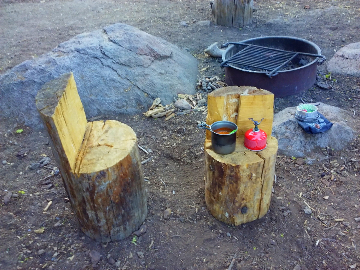
the kitchen caboodle
Day
8: There was a light breeze at daybreak. Broke camp at 8:40am. Met
“Bob” around midday, a guy about my age who was also thru-hiking
the trail clockwise. Like myself, he was also on day 8 but unlike me
he would be done two days from now! By his own account he had done
several 20-mile days and didn't seem to be enjoying his trip all that
much. Although I naturally go faster when traveling solo and CAN do
20 miles or more in a day, anything over 15 miles starts feeling less
like fun and more like work. Maybe that would change on a longer
trail like the PCT or CDT. I don't know, but hopefully I'll find out
someday. In the meantime, I celebrated passing the halfway
point of this thru-hike today at MM 105.
The
portion of the trail I am in now has plenty of water sources so there
is no need to carry more than a liter or so at a time. Of course,
everybody is different, but I seem to require about a liter for each
5 miles of travel to stay well-hydrated. Yes, temperature, humidity,
pack weight, and terrain all affect this to some degree, but as a
general rule and average, that's what works for me. I also employ
the “strategy” of only breathing through my nose. My personal
rule is, if I can't get enough air through my nose on the uphill
grinds, I'm moving too fast and it's time to slow down or take a
short break. This serves to automatically keep my heart rate from
redlining AND reduces the amount of fluid loss through evaporation in
my airway. At least that's my theory. YMMV.
The
trail passes near the Luther Campground at around MM 104. You can't
actually see the campground from the trail, but there is a narrow
paved road that leads to it. When the trail emerges from the woods
onto this paved road, there is no sign or other indication where the
TRT continues. Fortunately, I caught up to Bob again at this spot
and he had a guidebook that said to make our way to the SW corner of
the parking lot (which was up the road to the left and about 100 yards away). That bit of info saved me from needing to fire up
the “Backcountry Navigator” app on my phone to figure it out.
Speaking
of cell phones, let me talk a bit about navigation apps and the electronic
devices I choose to carry. First and foremost, the ubiquitous
smartphone. Virtually everyone has one now, and it's no wonder; they
are so useful. For backpacking, having your smartphone with you is a
no-brainer in my opinion. Of course, assuming there is a cell signal
where you happen to be in the woods, they are a handy communication
device that enables you to stay in touch with home or work, connect
with a hiking partner you have become separated from, summon
emergency services, get an updated weather report, check your email,
or even watch a netflix movie in your hammock. But what good are
they without “service”, which is often pretty weak or non-existent in the backcountry?
Perhaps most importantly, they can keep you from getting lost. There
are several good navigation apps out there that enable you to
pre-download maps before you leave home, and then use said maps,
combined with the satellite GPS capability built into most
smartphones, to geo-locate and display your exact position on the map, all
without needing a cell signal. Thus you can always know your
location relative to any trail or landmark. This can be a lifesaver
if you find yourself completely disoriented, or merely a timesaver to
help put you back on track if you happen to take a wrong turn. Also,
if you want to venture off-trail and try to find that cave you know
is out there somewhere but are worried about finding your way back,
the app can record a series of virtual breadcrumbs as you walk so
that you can always retrace your steps, day or night, or even in the
midst of a whiteout with zero visibility. There are some situations
where a paper map and compass are useless but a smartphone can save
your bacon. The app can also tell you your average hiking speed,
show you a profile of the trail's elevation changes, act as a
super-accurate pedometer, and display your exact GPS coordinates to
help SAR locate you quickly in an emergency.
Aside
from these critical capabilities of communication and navigation, a
smartphone can also perform many other helpful functions for you in
the woods, some of which you may not have thought of. Even without
“service” it can: take pictures and record video; tell you the
time; become a spare flashlight; play music; help you identify stars,
planets, and constellations; be a timer so you don't over- or
under-cook your ready-in-7-minutes Knorr's dinner; wake you up; lull
you to sleep with soothing ocean sounds or an e-book; be a mirror for
fixing your hair in the morning or getting that gnat out of your eye;
check the 30-degree angle of your hammock suspension; remind you that
it's your brother's birthday today; make a shopping list for the next
time you're in town to re-supply; calculate how much money you
still have in your hiking budget after that last in-town splurge; and
alert you when you finally DO have cell service. Plus, there are
innumerable apps out there which can expand that list tenfold. Some
are obviously frivolous, but as an example, one potentially useful
app I have on my phone is from the Red Cross and will show you how to
treat common medical situations in the woods if getting to a
hospital or clinic quickly is not possible. I haven't ever
needed it, but it's there and weighs nothing.
In
addition to the smartphone, on longer hikes I also carry an auxiliary battery and
short cable to recharge the phone if needed, a set of wired headphones which
are required to use the built-in FM radio in my phone in case I need
to get a weather report when there is no cell service, and a small
thermometer that also records the daily high and low temperature. I primarily use the thermometer to help with evaluating gear and clothing. That's it. For a little more than half a pound of carry weight you
get all that capability. So if you haven't yet gotten a navigation
app, get one and learn how to use it. You'll be glad you did.

Screenshot of the trail from my phone
Ok,
back to the story. I paused here at the narrow paved road to re-arrange the stuff
in my pack because it was beginning to look and sound like we might
have a thunderstorm. What?!? They have those here? It was funny
because this was the first time in all 8 days I had been on the trail
that there was even the slightest threat of rain. Nor had it rained
at all on the three day trip from Missouri. I had gotten lax about
keeping all the stuff in my backpack that absolutely needed to stay dry INSIDE the
compactor bag that I use to line my pack. After
shuffling things around a bit, I was ready for a downpour if it
occurred. I wondered... would THIS be the day that I finally got to
test out the new (to me) rain tarp that I
picked up used from an internet classified ad about a month before
departure? Stay tuned to find out!
I
found the continuation of the TRT as Bob said in the SW corner of the
parking lot. In addition to being the entrance for Luther
Campground, this lot also serves as the Big Meadow Trailhead. As I
was exiting the lot onto the single track, a coyote scooted across my
path. I didn't have time to get the camera out, but a coyote is
hardly picture-worthy anyway, unless of course it has an Acme Brand
Rocket Sled attached to it. In a short distance the trail crossed a
major paved road, CA 89. From there the climb began in earnest via
switchbacks. It was here that the rain started. Well, sort of. It
was more like an ultra-light shower, not even enough to warrant
putting on my now-easily-accessible rain jacket. Not much farther
along, the path emerged into, of all places, Big Meadow. Honestly, I
don't know why they call it that; there are much larger meadows all
over the place. This one was small by comparison. Anyway, meadows
are always pleasant to walk through. Except perhaps during a
thunderstorm. Tempting fate, I pushed on. Alas, I didn't get
struck. One-tenth of a mile later I was back in the woods and the
ascent began again. The sprinkle lasted maybe 10-15 minutes and it
was done. My t-shirt was dry about 5 minutes later. After a long,
3-mile uphill climb, I rolled into Round Lake at MM 107.5 around
5:45pm. I quickly found a good spot with two nice trees very close
to the water's edge, pitched the hammock, and proceeded to cook
dinner. As I ate from my cookpot, I wandered around the perimeter of
the lake to explore a bit. From the opposite shore I had a good view
of a large cliff that was now illuminated with the red light of the
setting sun. Very nice! Content in the knowledge that there was no
better place on the lake to hang my hammock than where I already had,
I returned to my spot. There was a large dead tree trunk lying on
the beach which made a good seat for filtering water, and while doing
so a fellow camper joined me for some conversation as evening turned into
night.
It
had been a long day, 17.9 miles on-trail and probably another half
mile exploring the lake. The low temp was 48 overnight, and the
elevation at Round Lake was 8041'. I'd rate this camping spot 9/10.
So...
did I end up using the tarp this night? NO! The clouds moved away
and the sky cleared before I even arrived at the lake. Gotta love
it!


Camp 7 at Round Lake

Sunset at Round Lake

View from the hammock in the morning
Day
9: Re-supply day! Broke camp at 8:50am. It was a pretty uneventful
day. That said, there was never a single day on the
trail that didn't have awesome long-range views. And even where the
trail passes through dense forest, it's still unbelievably gorgeous.
Majestic pines are everywhere you look. Massive cedars with trunks
larger around than I've ever seen in my life. I've already gone on
and on about the wildflowers which are prolific here. I jotted in my
notes that the trail often looks professionally landscaped. By that
I mean it's so beautiful that it's easy to believe there's a
guiding hand deciding what to plant and where for maximum aesthetic
effect. After being here, I think I now have an inkling of what
heaven must look like. The sights, the sounds, the smells, all
sublime. Even the textures are striking. I didn't encounter any
thorny plants anywhere on the trail. Is that just the because of the
time of year? I don't know, but I DO know that not once was I poked,
pricked, stabbed, or otherwise assaulted by something growing here.
And believe me, there were plenty of places where I brushed against
many different species of plant life. Ok, you get the idea. If
you're looking for a good place to hike, THIS IS IT.
I
reached the southernmost point on the TRT at
MM 109.7. It joins the PCT at this spot. From that junction, the trail generally headed northwest through a very pretty
valley. Someone used to live here; a few outbuildings are still
standing, leftovers from an old homestead. What a peaceful place!
Next I came to Showers Lake where I drew some water. There were a
few campers around and it looked like they'd been here for awhile. This is definitely a very nice place where one could spend a few days enjoying the
gorgeous scenery and exploring the area from a base camp. I'd have liked to stay longer... maybe pitch the hammock in a shady spot and let the summer breeze rock me to sleep until lunchtime... then go for a swim after lunch
and sprawl out on a rock in the sun to dry off. Gotta come back here
someday for sure!
I had
my actual (vs. imaginary) lunch around MM 116 in Bryan Meadow which
was very nice.

TRT / PCT Junction

Meadow at PCT Junction

Showers Lake

Yet another meadow full of wildflowers

Views that just won't quit!

Lunch at picturesque Bryan Meadow
I made it to the Echo Summit Trailhead (US 50) at MM120 around 3:40pm. The pre-arranged rendezvous time was 4pm, but my wife was 20 minutes early so neither of us had to wait! Perfect timing!
An
update on her condition: She stayed at a motel for the past two days
and nights and rested her ankle the whole time. The swelling has
mostly abated and she's feeling much better. However, the next leg
of the trail is through Desolation Wilderness and the terrain there
is very different from the rest of the TRT. We've read that you are
basically walking on "shards of granite" the whole way through. Miles
and miles of difficult, ankle-wrenching trail is what awaits all who
enter that area. So.... it seems prudent that she not risk it. I
will continue solo for another two days and then we'll re-evaluate again.
In
the meantime, before picking me up she had already checked us into
the AirBnB (#2). After being apprised of her situation and
condition, the host, Randy, went out of his way to offer assistance.
He carried her backpack and other belongings upstairs to the room, brought extra pillows so she
could prop up her sore foot, made a batch of freshly-ground coffee,
and even offered her some organic, locally-sourced ointment that had
THC in it (legal in California) (I think). Legal or not, she says it
worked very well and she felt instant pain relief. Imagine that!
Thank you Randy!
After
a quick shower and change of clothes we headed out to dinner at
“Izzy's Burger Spa” in SLT which came highly recommended. It was
good. Not spectacular, just good food reasonably priced. They had
outdoor seating which made it even better. I would eat there again.
Day
10: After breakfast at “Key's Cafe” (another place the locals go
to eat), it was back to the trail for me. I got underway at 10:50am.
It's normally uphill from any road crossing and this was no
exception. Two miles and about an hour later I emerged from the
forest on the south end of Echo Lake. From there the trail passes to
the east around the lake. Some hikers take a water taxi from this point
which eliminates about 4-5 miles of trail. I did not. The southern
border of Desolation Wilderness is here, although there was nothing
desolate about this particular spot. Tons of cars in the parking
lot, and tons of people wandering about. There were signs reminding
hikers that a “permission slip” was required to go beyond a
certain point on the trail. Or else what, I wondered. How many
don't comply, I wondered.
The
trail was immediately much more difficult. It was a good thing my
wife opted out of this section. But the views of the area were
great. Evidently there is private property around the perimeter of
this lake. All kinds of houses exist along the rugged shoreline,
everything from cute little cabins to extravagant mansions. I assume
the owners all have to keep boats at the marina to access their
properties; I didn't see any roads or vehicles once I got past the
parking area. There were also lots of dayhikers in this section,
some just carrying towels as if they were headed for some secluded
beach which I never saw.

Hobbit house on Echo Lake
As
I left Echo Lake behind me around MM 125, the crowds quickly thinned
out. The trail also continued to get even rougher and had now become
the exact antithesis of the soft footpath which predominated during
the first half of this TRT journey. The surface that was previously
99.5% duff had transformed into rocks, rocks, and more rocks,
reminiscent of my experience on the AT in “Rocksylvania”
many years ago.

They weren't kidding about the rocky trail in Desolation Wilderness
I stopped for lunch and while I was eating, a ranger came by. This was the first one I had seen since starting the trail 10 days prior. He asked if my permit was current. I said yup and that was good enough for him, no need to display it.
This is truly the land of lakes. After Echo came Aloha, then Heather, Susie, and finally Gillmore at MM 133 where I quit for the day. All of them were gems and worthy of further exploration (on a subsequent visit). I was surprised that there were so many people at Gillmore since I didn't see many hikers on the trail in the hour or two before arriving. The few folks I DID see along the way that afternoon were mostly PCT thru-hikers going the other way who had flip-flopped because of the deep snow in the Sierras in June and were now working on “closing the gap”. They had already been on the trail for about four months and were currently within a few weeks of finishing their 2650-mile trek. And here I was on “day 10” of my own comparatively inconsequential journey. I stood in awe of their accomplishment, astonished that they would even stop to talk to me.

Lake Aloha

Heather Lake

"shards of granite" (aka scree)
When
I first arrived at Gillmore it was difficult to find a spot. How
close is too close to your neighbor? I didn't know, but eventually
settled on a pair of trees that I felt did not encroach on anyone's
territory. Don't get the wrong idea... when I say there were “many”
other campers here, I mean maybe a dozen. And from where I hung my
hammock I could only see two of them.
Shortly
after I arrived, a tiny twentysomething Asian woman rolled in and
was having the same dilemma as me. She eventually found a spot to
pitch a tent for herself and her dog. They were a perfect match:
she probably weighed all of 80 pounds soaking wet, and her dog was
about as small as they come. I wondered how someone as petite as her
could carry a full backpacking kit on a trail such as this. And her
little dog! That thing might have been 5 pounds max, so it sure as
heck wasn't gonna be carrying any additional weight. Which meant its
OWNER must have been carrying its food and water and whatever else it
needed. And those little 4” legs... could it even keep up on the
trail? Could it walk more than a mile in a day? Could it leap tall boulders in a single bound? She said it was 11
years old, not exactly a spring chicken! Again, it was a mystery to
me, and remains such. They were gone in the morning before I got up.
During
the night I was awakened by other campers yelling and making a racket
trying to scare a bear away. I never saw the bear. To my knowledge,
it never came near my hammock, and my canister was undisturbed in the
morning. But the yelling persisted for about 30 minutes, possibly
longer. I may have slept through some of it.
I
hiked 13.0 miles this day, even with starting so late in the morning
and the rugged terrain. The elevation at Gillmore was 8320' and the
low temp overnight was 51 degrees. I'd rate this campsite 8.5/10.

"Ginger" the wonder dog

Camp 8 at Gillmore Lake
Day
11: Woke up at 8:10 and broke camp at 9:45. The trail headed uphill
almost immediately and passed to the east of Half Moon Lake which is
nestled in a bowl and looked like an interesting place to explore
someday. I had heard that Dick's Pass was grueling, and that was
where I was headed next. Actually, I didn't find it all that
difficult a climb, probably because there was a lot of uphill on the
way to Gillmore the previous day. I got to the top of the pass right
at 11:00am and paused for a snack while enjoying the amazing view.
Next it was down to Dick's Lake, and then on to Fontanillis Lake
where I replenished my water supply.

I don't know how much more of this I can take...

Dick's Pass
Many
backpackers stop along the way to swim in these secluded lakes and I
came upon a pair of young women who were preparing to do just that in
Fontanillis. It was midday, sunny, and very warm, so there was no
better time to take a dip. Personally, I found the lake water too
cold to be enticing. If I jumped in, it would only be for a moment
and just to be able to say I did... hardly worth the trouble. To be
honest, I DID wonder if the girls were planning on skinny dipping,
but to be gentlemanly I didn't stick around to find out.
Next
were Upper and Middle Velma Lakes. This was supposed to be one of
the places where bears were having a heyday stealing camper's food.
I made it a point to pause often and scan the area for movement
hoping to catch a glimpse of one of them, but it was not to be. A
few miles later I reached the northern border of the Desolation
Wilderness. I had read somewhere that DW is one of the most popular
hiking areas in the country. While I certainly see the appeal, I
think the eastern side of Lake Tahoe is prettier. Just my opinion.
While
solo hiking, one has lots of time to ponder various things. Long
stretches of trail without any human interaction will inevitably
produce random and sometimes wild thoughts. Consider this example:
At the time of this backpacking trip, there were thousands, probably
millions, of grasshoppers flying about, especially in the meadows.
As I was plodding along one day looking down at the trail, I watched
as grasshopper after grasshopper made way for my passage. But not
all of them reacted the same to my approach. After observing
this for quite some time, I came to the following conclusion, which
may or may not have some application to humans. The smart
grasshoppers (which were the vast majority) would hop-fly perpendicular to the trail, thereby
minimizing the amount of energy required to avoid being squashed by
this relative giant in their midst. One quick motion and they were
completely out of danger and free to go back to whatever they were doing before the intrusion. The “smarter” grasshoppers on the
other hand would instead fly about five feet ahead of me
and land directly on the trail again, pause for a second or two, and then repeat the process over
and over again as I continued to walk in their direction. Sometimes
the same grasshopper would perform this action a dozen times or more
before finally moving to the side to catch his (or her) breath. [I consider it a safe assumption that all grasshoppers are either male or female and therefore don't mind me using those pronouns]. I could
only guess that these smarter grasshoppers were (at great personal
risk to themselves) studying human behavior and hoped to one day have
their findings published in some prestigious scientific journal which
might ultimately lead to them eventually being recognized by
grasshoppers worldwide as an expert in their field. They could then
command a large salary by teaching at a well-respected grasshopper
university, appear on GTV as an expert on how to best avoid being
attacked and killed by those vicious, bloodthirsty humans, and maybe
even secure a multi-million-dollar government grant to do even more
in-depth studies of humans walking on backcountry trails in the
western United States. Finally, there were some grasshoppers that
neither flew perpendicular to nor along the trail ahead of me. In
fact, they did not move at all. I surmised that THESE grasshoppers
were the smartest of all because they had learned, probably through
simple observation, that humans on the trail were no threat
whatsoever and they didn't need to fret about their approach or waste
any time or effort moving out of the way. Indeed, they had seen with
their own compound eyes that humans walking on the trail would,
without exception, alter their stride as required in order to AVOID stomping on
any grasshopper that was “in the way”. They never read this in
any book, or learned it in any classroom, but nevertheless it was
true. Unfortunately, most of their peers could not accept this idea, it was
simply too radical a concept. My conclusion? All grasshoppers are smart in
their own way.
OK,
back to reality. My ultimate goal for the day was Richardson Lake at
MM 148.3 and I arrived there at 5:15pm. There were a few other
campers already settled, so I found a nice spot on the lakeshore for
myself and hung the hammock. After taking care of the usual camp
chores and cooking some dinner, I set out to explore the rest of the
lake and perhaps meet some of my temporary neighbors. I ended up
chatting for a while with “Trish”, a solo backpacker who was
section-hiking the TRT and headed in the same direction as me. We
talked about gear for a bit... she owned some of the best, including
a Z-packs Duplex Tent. Interestingly, when I got around to telling her the story of my
wife's unfortunate injury, she already knew all about it from Facebook. HA!
Evidently my wife had posted something on there while hanging out at
the motel so that our family back home would know what was happening
with us, and this complete stranger camped next to me had already
stumbled upon it. What a hoot!
It
was a pleasant night. I had traveled 15.3 miles this day. I would
rate this campsite 9/10.

Camp 9 at Richardson Lake
Day
12: While brushing my teeth after breakfast, a deer quietly strolled
up about 20' away, looked right at me, then moseyed along down the
trail as if this was a petting zoo. I've encountered plenty of deer
before while hiking, but this was the first one I had seen on this
trip and was glad it was at close range and that it didn't feel the
need to bolt from my presence.

Deer at Richardson Lake
I
broke camp at 9:45am and continued north on the trail. The updated
plan for today was to meet my wife at Barker Pass (MM 154.7) which
has road access and a trailhead. The original plan had the two of us
ubering (is that a word?) from the pass into Tahoe City (and back) to
retrieve our last re-supply box, but instead she just brought some
fresh fruit to hold me over for one more day. She was already
waiting for me when I got to the pass a little after noon and we
shared a leisurely lunch at a picnic table in the shade. While
there, Trish caught up and the three of us visited for awhile.
Trish's car was parked at the pass so this was the end of the line
for her. It was very nice meeting such a friendly person along the
way.
An
update on my wife's story: When she and I shared the AirBnB at
Randy's place a few days ago, she was unsure where to stay next while
I continued hiking the trail. It was now closing in on the Labor Day holiday, and
all the rooms in the Lake Tahoe vicinity were either already reserved
or way too expensive for our budget. I told her about the car-camping
campground I saw down near Big Meadow, and not knowing anything about
it (it was not even visible from the trail), I suggested she check it
out asap. Whatever she ended up doing, time was of the
essence. We had plenty of car-camping
gear with us, and how much could it cost to stay at a campground per
night, $20? Well... she headed there the next morning to find out if that was even an option. It turned out
that Luther Campground was free. Unfortunately though, all the sites
were already taken. However... as my wife drove through, another
camper noticed her searching for an unoccupied site and told her that
the site next to hers (which already had a tent on it) MIGHT be available. Wait... what? The woman explained that the tent that was
on the site had been put up by another woman “quite a while ago”, and that she
had not been there for at least a full week. Also, there was no registration ticket on the
numbered post reserving the site, so this stranger suggested that my
wife stake her claim (the sites were big enough for several tents to
occupy them simultaneously) and see what happened. So my wife did
just that and put up our own two-person tent on that site and made herself at home.
Luther
turned out to be a very nice and clean campground with pit toilets,
fire rings, picnic tables, bear boxes, and there was even a good-sized creek flowing through it right behind the sites. All for free!
What a find!
The
next day, the mystery woman who owned the vacant tent showed up. My wife
approached her to apologize for commandeering the campsite, but the
woman said she was only there to get a few of her belongings and wouldn't
be staying. The woman then explained to my wife that she had been
homeless for a while, but now had a place to stay and was done
camping on this site. She grabbed a few items from the tent and then told my wife that she could have the tent and
everything left in it if she wanted, and then drove away. Wow.
So
what was in the tent? A crockpot. Some cookware and utensils. Ski
gloves, pants, and goggles. Some miscellaneous clothing, all in good
condition. A few pairs of shoes, and a nice blanket. Some of the
stuff we will keep and in fact have already used. The balance of it
will go to goodwill. My wife left the tent up to make the campsite
look more “occupied” when she wasn't around, but had already made
friends with some of the neighbors and felt completely safe there by herself.
Later
that second day, my wife noticed a car driving around, its occupants
obviously hoping to find an available site (there were none).
Seizing the opportunity to “pay it forward”, my wife flagged down
the car and offered to share her site with them. They turned out to
be a nice young couple, Olivia and Bryan, from Salt Lake City who had come to Tahoe for
a few days to kayak and explore the lake. That evening, as
appreciation for offering to share the campsite, they cooked up an
incredible salmon dinner with fresh organic vegetables and invited my
wife to share the meal with them. When they headed home a couple of
days later, they left a very nice note of thanks with their phone numbers
and an invitation to visit them if we were ever in the SLC area.
It's incredible how things work out sometimes. Kinda reminds me of
this old song: https://www.youtube.com/watch?v=x6DLsf8VG5Y
At
3:00pm my wife and I reluctantly parted at the Barker Pass
intersection and I continued on the trail toward Tahoe City. At MM
159.5, the TRT once again became its own trail when the PCT split off
to the left. I was intending to camp a short way past that
at “Twin Peaks Saddle” (MM 160.0) where there was supposed to be
a nice site. The TRT runs along the shoulder of the two peaks (not the ridgeline), so on
the map it appeared that in order to get to the saddle I'd have to go
off-trail. The side of the mountain was pretty steep, and I kept
watching for any evidence of a spur trail that would bring me up to
the saddle, but never saw any. At the spot where the TRT was closest
to the saddle, I left the trail in an attempt to bushwhack my way up
there, but it was very difficult terrain, and it didn't look like
there were any trees up there anyway, so I quickly abandoned that
idea. I'm sure there's a way up there, I just couldn't find it.
Maybe next time.
I
continued onward for another ¾ mile and found some nice
sites with a view at around MM 160.7. I picked one and set up. I
hadn't seen any other people in hours and it was already late
afternoon, so it looked like I'd have the place all to myself, which
is how it turned out. I had traveled 12.4 miles this day. The
elevation here was 8120'. The low temp overnight was 53 degrees.
I'd rate this spot 8.5/10.

Camp 10 near Twin Peaks
Day
13: Broke camp at 7:35am. It was going to be a long descent into
Ward Canyon, so I chose to eat breakfast on-the-go. Can't do that on
the uphills, but it's no problem on the down! I was meeting my wife
again today, this time in Tahoe City. I got there (MM 171.0) around
11:15 and was immediately surrounded by hordes of people getting
ready to raft on the Truckee River. There were already wall-to-wall
boats floating by with several more being added every minute. The
river is only maybe 30' wide at this location and there were so
many boats floating in it that you could probably make it across
from one bank to the other without getting wet by hopping from raft to raft. Literally hundreds
of people hooting and hollering and having a good old time. This is
fun? I love to kayak and enjoy river camping immensely (the boat
carries all the gear!), but this was not my idea of a good time. But
hey, they probably feel the same way about those crazy backpackers
who climb mountains with 30 pounds on their backs and call it fun.
To each their own!
Unsurprisingly
for Labor Day weekend, the city was very busy with lots of
stop-and-go traffic creeping along. It took a little while for my
wife to make her way to where I emerged from the trail, but we eventually
hooked up. We retrieved the last re-supply box from Alpenglow Sports
in town and then headed back to her campsite at Luther to spend the
night together. Along the way we stopped in Incline Village and had
lunch at Lupita's Mexican Grill. When we later got back to the
campground, it had been a while since my last shower so I took one in
the woods near the campground using a 5-gallon solar shower that we
brought with us from home. It was too late in the afternoon to benefit from
the solar heating feature, so we used one of the pots abandoned by
the no-longer-homeless woman to warm some water on the campstove.
First time out of the box, the shower worked like a charm! Later
that evening we had dinner at Tep's Villa Roma in SLT. Both they and Lupita's
had good food at decent prices.
I
had walked 10.3 miles this morning. Not quite a “10 before 10”
day, but close enough for me!
Day
14: We left Luther campground around 7am to avoid holiday traffic and ate
at Rosie's in Tahoe City (again). What were we thinking? Like I
said previously, it's slim pickins in TC at 8am. Sounds like a good
opportunity for someone in the restaurant business to cash in. Just
sayin.
After
breakfast we walked the boulevard for a bit, then went down to the
beach for a while. I was only planning on doing around 8 miles today
so was in no rush to hit the trail. We lingered on the beach for
over an hour, soaking up the early morning rays and listening to the
little waves lap the shoreline... very pleasant. Eventually more and
more people started coming and claiming their 100 square foot piece
of real-estate for the day, so we left.

The Beach at Tahoe City
I
got back on the trail at 11:45am and started the long, steep climb
out of TC. Stopped for lunch between 2-3pm at an overlook. Ahhh...
I will miss these incredible views! The campsite I had planned to use that night at
MM 7.9 was very nice, but it was too early to stop when I got there
so I kept going. Besides, there was supposed to be a “dependable”
stream at 7.0 but it was dry. I had carried two liters from town,
but what was left of that was not going to be enough for a dry
camp. After consulting the map, I realized that the next for-sure
water was at Watson Lake. I never intended to go that far today, but
I checked the time and decided that it was doable, so made the
decision to go for it. A while later I texted the wife to tell her
the change of plans and to give her a heads-up that I would be done
earlier than expected the next day.

Pop Quiz: This location and these two trees look perfect for .......
I
rolled into Watson (MM 13.6) at 6:15pm. I had read somewhere that
this is sometimes a party spot because it has road access. Not
tonight. It was peaceful and quiet. There were a couple of
car-campers and a small RV here before me, but as far as I know I was
the only backpacker. They call Watson a lake, but it's really just a
pond; it looked pretty shallow and I saw no inlet or outlet.
Curiously, they have bear boxes and fire rings here, but no picnic
tables. The pond was clear enough to draw water from. There were
lots of good trees for hammockers, so it was a nice place to spend
the night. Speaking of which, this was to be my last night on the
trail and I hadn't seen even one other hammock camper in all two
weeks. Before coming to Tahoe I was uncertain if hammocks were a
good choice for this area and even carried a CCF pad for a while in
addition to my underquilt in case I had to “go to ground” in the
absence of trees. But I'm here to tell you that you will have no
problem finding places to hang along the trail, regardless of
elevation. One important side note though... I use 15'-long straps
as my standard hanging setup. Many of the trees here are HUGE.
There were times I had very little extra strapping left after running
it around a large trunk. If you want to maximize your hanging
options on this trail, be sure to account for those large-diameter
monsters when deciding what suspension to bring with your hammock.
As
noted, it was a 13.6 mile day. Low temp was 51 overnight, elevation
7805'. I would rate Watson Campground 8/10.

Size matters!
No picnic tables at Watson... good thing I packed in my chainsaw! (j/k)

Camp 11 at Watson Lake (last night on the trail)
By
the way, in regard to my campsite rating system... keep in mind that
it is just my personal opinion and your mileage may (and probably
will) vary. I am partial to high, secluded, ridgetop campsites with
long-range views, and my ratings reflect that. If you prefer
lakeside camping, you would likely find most of the lakes I camped at
a perfect 10. Not one of the places I camped was bad; all were good,
and most were actually great. Several of the trip reports I read
before coming here talked about mosquitoes being a problem in some
areas, including a person that described one of their camping
locations as “mosquito hell”. I did not find those pests to be a
problem at all on this visit, but I'm sure the bug population swells
and shrinks with weather patterns. That kind of evaluation is
hit-or-miss, luck-of-the-draw, and skeeters can easily make even the
best camping location sheer misery if you hit it on a bad night.
Day
15: Broke camp at 8:40am and finished the last 6.4 miles to the
Brockway Trailhead (MM 20) by 11:40am. Wife was there waiting. Like
all long backpacking trips, the finish line is always a bittersweet
affair... glad it's done, but sad it's over. Even more so this time
because I didn't get to share the whole journey with my sweetie. Oh,
well... we'll just have to come back next year and try it again!

One last long look before the end
Epilogue:
The
trip back to Missouri was fairly uneventful and, of course,
anti-climactic, so my descriptions will be brief. As soon as I
completed the trail, we headed toward home, sort of. We opted to
take “the southern route” back just so we weren't retracing our
steps, although that would have been fine too. From Brockway we
headed north a short way and hopped on I-80 east to US 95 south. By
the end of the day we made it as far as Beatty, NV, which happened to
be the gateway to Death Valley National Park. We got a cheap motel
room for the night so we could take showers.
The
next day we continued south on US 95 to I-40 and then headed east,
making it all the way through Arizona to Gallup, NM which is about
20 miles from the AZ border. We had planned to stay at a free
campground that night called “Quaking Aspen CG” which is another
13 miles past Gallup, plus about 8 miles south of the interstate on
NM 400, but due to a time miscalculation it was already dark when we
got to Gallup and we didn't want to try to find this place and set up
at night, so we just got another motel room in Gallup. The motel we
stayed at there was the Royal Holiday, cheap but clean and safe. I
only mention this place because they offer a free continental
breakfast. But... doesn't everyone? I need a full breakfast in the
morning and continentals don't cut it. But... the owner of this
motel, a very nice woman (Ms. Patel) will personally make you
Belgian waffles in her own kitchen if you ask. Now we're talking!
So, as far as I'm concerned, this is the best deal for overnight
accommodations in Gallup.
The
next day after leaving the motel, we did go check out that free Quaking Aspen Campground to
see what we missed (if anything). Turns out it would have been
perfect and saved us fifty bucks, but then we would have missed out
on Ms. Patel's free waffles. Anyway, now we know that the free
campground is a winner if we're ever in that area again.
At the end of this travel day we made it to exit 128 near McLean, TX and drove north on FM 2477 a few miles to McClellan Creek National Grasslands. There is a campground there with pit toilets, picnic tables, fire rings, and water hydrants. It costs $10 per night, but you can use your “America the Beautiful” pass (or equivalent) if you got one. We do, so our cost was $5, remitted via an honor system envelope. There were only two other campers there on the night we stayed and room for lots more, so we had plenty of privacy. There were good trees for hanging, and we had a nice, quiet night's rest. No complaints!
At the end of this travel day we made it to exit 128 near McLean, TX and drove north on FM 2477 a few miles to McClellan Creek National Grasslands. There is a campground there with pit toilets, picnic tables, fire rings, and water hydrants. It costs $10 per night, but you can use your “America the Beautiful” pass (or equivalent) if you got one. We do, so our cost was $5, remitted via an honor system envelope. There were only two other campers there on the night we stayed and room for lots more, so we had plenty of privacy. There were good trees for hanging, and we had a nice, quiet night's rest. No complaints!
From
there it was only one more day's drive home, so that's the end of the
story. Except...
A few final thoughts:
Neither of us needed to use our tarps on this whole trip, and in fact we never
even took them out of our packs. The weather was idyllic the entire time
we were in the Tahoe area. Brilliant sunshine and mid 70's to around
80 during the days and right around 50 every night. Extremely low
humidity too, which makes summer hiking very enjoyable and also means no
morning dew on your stuff! I wouldn't be surprised if the people who
live around there don't even know what dew is.
Surprisingly, neither my wife nor I got even one tick on us the whole trip and
neither of us used any type of insect repellent at all. In addition
to normal, frequent contact with various types of vegetation along
the trail each day, the time when I went searching for water at
Marlette I walked off-trail through dense undergrowth for about a
mile total, brushing against tall grass and weeds the entire time.
No ticks, no chiggers. This is quite a contrast to what we
experience here in the Ozarks. I have also lived in southern NJ and
it was the same there... you simply don't go into the woods in summer
without slathering on the bug juice, which I am not willing to do, so
I just restrict my local hiking to the colder months. In fact, I
thru-hiked the Ozark Trail two years ago in February and still
got several ticks on me! (That trip report is also posted on my blog if you want to read it) The only risk you might
have from insects in Tahoe as far as I can tell is being stung by a
bee. The wildflowers are abundant along the trail, and naturally the
bees are attracted to them. There were a few spots where the plants
were shoulder high and draped over the trail. There was no way to
pass through these areas without walking through a gauntlet of bees,
thousands of them. I am somewhat allergic and the possibility of getting stung multiple
times was indeed a concern, but all I could do to minimize the danger
was use my hands to close up the pant legs of my shorts so no bees would get trapped under my clothing. I guess it worked, but
I was still surprised each time when I didn't get even one sting on
my exposed arms and legs. This danger is probably far less most of
the time. It seemed like we were hiking during the peak of
wildflower season, which apparently changes each year based on the
previous winter's snowfall accumulation.
The
sun is very strong here. Not only because it shines
brightly just about all day every day, but because of the higher
altitude there is less atmosphere to filter the UV rays. You will
probably want to wear a good pair of sunglasses most of the day, and
you will definitely need sunscreen. I was not diligent
about applying it during the first couple of days on the trail and almost
burned to a crisp. I quickly learned to put some on in the morning
before setting out and again after lunch. Of course everyone is
different and YMMV depending on your skin type, but make sure you
have some in your kit.
As
for my gear... I ditched a few items along the way:
2. I
started out with a pair of long johns for sleeping in. Not needed
for this trip, especially with the 0-degree top quilt. Savings: 6.2
ounces.
3. I
started with two short-sleeved t-shirts. I ditched the black one
because it was soaking up too much solar energy. The light gray one
was much more comfortable in the strong sun, and because of the low
humidity, my shirt never got soaked with sweat so carrying two was
unnecessary. Savings: 5.9 ounces.
Stuff
I didn't ditch but never used and wouldn't bring next time: gaiters,
gloves, mosquito headnet, wristwatch. Savings: 4.2 ounces (total).
Stuff
I never used but would still bring next time: tarp, rain jacket.
Finally, if you are looking for a scenic trail to hike, the TRT is truly worth a trip from anywhere. You will not be disappointed. If you can't hike the whole trail in one shot, I would recommend doing the eastern portion first. Just be prepared to carry extra water. If the extra water weight is a concern and/or you prefer lakeside camping, then do the western portion first. I hope you found this report helpful in some way, but keep in mind that everything I have written here is merely my own subjective opinion. Thanks for reading!